
IMAGES TAKEN NEAR TO
Fernhill Lane, COVENTRY, CV7 7AN
Introduction
This page details the photographs taken nearby to Fernhill Lane, CV7 7AN by members of the Geograph project.
The Geograph project started in 2005 with the aim of publishing, organising and preserving representative images for every square kilometre of Great Britain, Ireland and the Isle of Man.

There are currently over 7.5m images from over14,400 individuals and you can help contribute to the project by visiting https://www.geograph.org.uk
Image Map
Images are licensed for reuse under creativecommons.org/licenses/by-sa/2.0
Notes
- Clicking on the map will re-center to the selected point.
- The higher the marker number, the further away the image location is from the centre of the postcode.
Image Listing (19 Images Found)
Images are licensed for reuse under creativecommons.org/licenses/by-sa/2.0
Image
Details
Distance
1
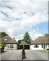
Bungalows, Fernhill Lane
The planes fly over in quick succession on the approach to Birmingham Airport. The bungalows have a Cornish flavour: Tresco on the left and Helford on the right.
Image: © Robin Stott
Taken: 11 Aug 2010
0.12 miles
2
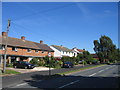
Balsall Street
Houses to the north of the road from Knowle typify the residential area in the northern half of this square.
Image: © David Stowell
Taken: 21 Aug 2005
0.14 miles
3
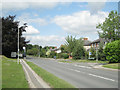
Balsall Street B4101
Looking from the corner of Fernhill Lane west past the junction with Needlers End Lane. There is a postbox opposite the bus stop, number CV7 139.
Image: © Robin Stott
Taken: 11 Aug 2010
0.15 miles
4
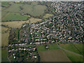
Balsall Common from the air
The B4101 Balsall Street in the west side of Balsall Common is prominent. Viewed from a Birmingham bound flight from Prague.
Image: © Thomas Nugent
Taken: 11 Feb 2022
0.15 miles
5
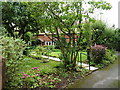
Wisteria Cottage, Balsall Street
A 17th century, timber-framed cottage on the outskirts of Balsall Street, Wisteria Cottage was given a Grade II listing https://www.britishlistedbuildings.co.uk/101343240-wisteria-cottage-balsall#.Wbg9ttQrLGg in 1972. It's not easily visible from the road.
Image: © Richard Law
Taken: 22 Aug 2017
0.15 miles
6
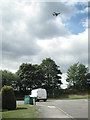
Shenstone Drive meets Balsall Street
The area is close to the flightpath into Birmingham Airport. On a weekday morning planes were going over every few minutes.
Image: © Robin Stott
Taken: 11 Aug 2010
0.15 miles
7
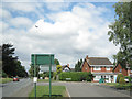
Balsall Street - under the flightpath
Balsall Street left and foreground, at the junction with Shenstone Drive. The black and white gable belongs to Shenstone Grange, a Grade II listed building. Outwardly Edwardian, it encapsulates a nationally significant 17th-century timber-framed house. It is home to the Island Project, a charity providing education for autistic children. http://www.theislandproject.co.uk http://www.britishlistedbuildings.co.uk/en-495898-shenstone-grange-balsall
Image: © Robin Stott
Taken: 11 Aug 2010
0.15 miles
8
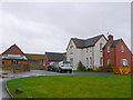
Fern Hill Farm
Although there are a large number of farm buildings here this is not a working farm but has been converted to residential use only. There are several horse paddocks close by.
Image: © Nigel Mykura
Taken: 20 Nov 2012
0.17 miles
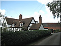
10
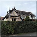
Shenstone Grange, Balsall Street
This historic Balsall Common house undergoing repairs is Grade II listed; it dates from the 17th century, with additions from the 19th and early 20th centuries. The old house stood at right angles to the road; its gable end can be seen to the left, with the Edwardian (early C20) range to the right. When listed in 2006, the house was rendered with roughcast, but the internal timber-framing was well-preserved. At least some of the roughcast appears to have been removed, and it looks as though new timbers have been applied to the front, probably replicating the internal structure. See the listing at the Historic England site https://historicengland.org.uk/listing/the-list/list-entry/1391724?section=official-list-entry . Balsall Common is a mainly 20th century suburban settlement, but is dotted with older buildings from its rural Berkswell past. See also Image
Image: © A J Paxton
Taken: 10 Oct 2023
0.18 miles