
IMAGES TAKEN NEAR TO
Elkington Street, COVENTRY, CV6 7GG
Introduction
This page details the photographs taken nearby to Elkington Street, CV6 7GG by members of the Geograph project.
The Geograph project started in 2005 with the aim of publishing, organising and preserving representative images for every square kilometre of Great Britain, Ireland and the Isle of Man.

There are currently over 7.5m images from over14,400 individuals and you can help contribute to the project by visiting https://www.geograph.org.uk
Image Map
Images are licensed for reuse under creativecommons.org/licenses/by-sa/2.0
Notes
- Clicking on the map will re-center to the selected point.
- The higher the marker number, the further away the image location is from the centre of the postcode.
Image Listing (87 Images Found)
Images are licensed for reuse under creativecommons.org/licenses/by-sa/2.0
Image
Details
Distance
1
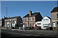
Coventry-Bell Green Road
A mixture of houses and small businesses near the junction with Phoenix Way.
Image: © Ian Rob
Taken: 9 Jan 2011
0.15 miles
5
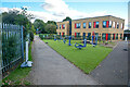
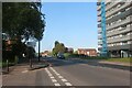
Coventry : Little Heath Primary School
A primary school on Old Church Road.
Image: © Lewis Clarke
Taken: 25 Sep 2021
0.19 miles
6
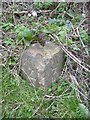
Old milemarker by Foleshill, Coventry
Milemarker by the Coventry Canal, in parish of Coventry (Coventry District), Foleshill, 220m North of Bridge No 6 in grass.
Inscription reads:-
: 4 : : 3 :
Carved bench mark on right face.
Surveyed
Milestone Society National ID: COV-03
Image: © Milestone Society
Taken: Unknown
0.19 miles
7
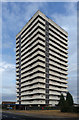
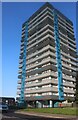
Longfield House, Bell Green Road, Coventry
One of a number of similarly-styled tower blocks dotted about the northern fringes of Coventry, standing like sentries as if to provide early warning of incursions by Nuneaton or Hinckley. They are distinguished by projecting white concrete bands and closely resemble designs by City Architect, Arthur Ling. Built c1961.
Image: © Stephen Richards
Taken: 22 Aug 2011
0.19 miles
8
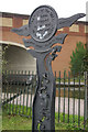
Spring Road entrance marker, Coventry Canal
This sign marks the entrance to the towpath close to bridge 6A which carries the A444, Phoenix Way, where the Coventry Loop Line railway used to run. This industrial area suffered particularly badly during the Coventry blitz; in some cases, the canal water was used to extinguish the fires.
Image: © Stephen McKay
Taken: 19 Oct 2008
0.20 miles
9
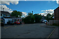
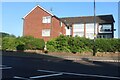
Coventry : Spring Road
A residential road.
Image: © Lewis Clarke
Taken: 25 Sep 2021
0.20 miles
10
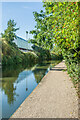
Coventry Canal
A section of the Coventry Canal, with Gallagher Retail Park on the left, built on the site of the Alfred Herbert machine tool factory, in its heydey in the first half 20th Century one of the largest such manufacturers in the world. However, following decline and various takeovers it eventually ceased operations in 1983.
Image: © Ian Capper
Taken: 23 Sep 2021
0.20 miles