
IMAGES TAKEN NEAR TO
Doyle Drive, COVENTRY, CV6 6NW
Introduction
This page details the photographs taken nearby to Doyle Drive, CV6 6NW by members of the Geograph project.
The Geograph project started in 2005 with the aim of publishing, organising and preserving representative images for every square kilometre of Great Britain, Ireland and the Isle of Man.

There are currently over 7.5m images from over14,400 individuals and you can help contribute to the project by visiting https://www.geograph.org.uk
Image Map
Images are licensed for reuse under creativecommons.org/licenses/by-sa/2.0
Notes
- Clicking on the map will re-center to the selected point.
- The higher the marker number, the further away the image location is from the centre of the postcode.
Image Listing (107 Images Found)
Images are licensed for reuse under creativecommons.org/licenses/by-sa/2.0
Image
Details
Distance
1
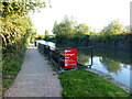
Canal overflow weir, Coventry Canal
Excess water will drain into the nearby River Sowe.
Image: © Ruth Sharville
Taken: 23 Sep 2021
0.07 miles
2
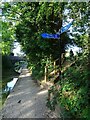
Judd's Lane Bridge
The pedestrian access to the bridge from the canal is a short distance from the bridge itself.
Image: © Anne Burgess
Taken: 23 Sep 2021
0.08 miles
4
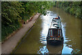
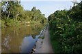
Coventry : Coventry Canal
Looking along the canal.
Image: © Lewis Clarke
Taken: 25 Sep 2021
0.08 miles
5
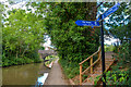
Coventry : Coventry Canal
Looking along the canal, approaching the bridge.
Image: © Lewis Clarke
Taken: 25 Sep 2021
0.08 miles
7
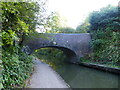
Bridge number 9 over the Coventry Canal
This footbridge leads to the Coventry Arena (formerly the Ricoh stadium, now the CBS (Coventry Building Society) Arena).
Image: © Ruth Sharville
Taken: 23 Sep 2021
0.08 miles
8
![A stroll along the Coventry Canal to Hawkesbury Junction [37]](https://s3.geograph.org.uk/geophotos/07/12/19/7121967_f6bb4dc3_120x120.jpg)
A stroll along the Coventry Canal to Hawkesbury Junction [37]
Bridge number 9 which carries a footpath which leads to the CBS Arena.
The narrow canal was built to connect the city of Coventry with the Trent & Mersey Canal, some 38 miles distant, to exploit the Warwickshire coalfields. Construction of the canal took 20 years before it was complete in 1769. The canal between the basin in Coventry and Hawkesbury junction was made a conservation area in 2012.
Image: © Michael Dibb
Taken: 23 Sep 2021
0.08 miles
9
![A stroll along the Coventry Canal to Hawkesbury Junction [36]](https://s3.geograph.org.uk/geophotos/07/12/19/7121963_f1c3f2ec_120x120.jpg)
A stroll along the Coventry Canal to Hawkesbury Junction [36]
Still in the Coventry suburbs and not far from the CBS Arena, yet the canal appears to be deep in the countryside.
The narrow canal was built to connect the city of Coventry with the Trent & Mersey Canal, some 38 miles distant, to exploit the Warwickshire coalfields. Construction of the canal took 20 years before it was complete in 1769. The canal between the basin in Coventry and Hawkesbury junction was made a conservation area in 2012.
Image: © Michael Dibb
Taken: 23 Sep 2021
0.08 miles
10
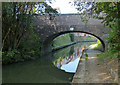
Bridge 9: Judds Lane Bridge
Crossing the Coventry Canal in the Longford area of Coventry.
Image: © Mat Fascione
Taken: 11 Sep 2014
0.09 miles