
IMAGES TAKEN NEAR TO
Hurst Road, COVENTRY, CV6 6EL
Introduction
This page details the photographs taken nearby to Hurst Road, CV6 6EL by members of the Geograph project.
The Geograph project started in 2005 with the aim of publishing, organising and preserving representative images for every square kilometre of Great Britain, Ireland and the Isle of Man.

There are currently over 7.5m images from over14,400 individuals and you can help contribute to the project by visiting https://www.geograph.org.uk
Image Map
Images are licensed for reuse under creativecommons.org/licenses/by-sa/2.0
Notes
- Clicking on the map will re-center to the selected point.
- The higher the marker number, the further away the image location is from the centre of the postcode.
Image Listing (67 Images Found)
Images are licensed for reuse under creativecommons.org/licenses/by-sa/2.0
Image
Details
Distance
1
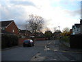
Hurst Road, Longford
Hurst Road is divided into two sections for vehicular traffic by a fence that is not all that easy to see in feeble light of an early evening in November. There appear to be several decades between the houses on the two sides of the road.
Image: © Richard Vince
Taken: 10 Nov 2012
0.06 miles
2
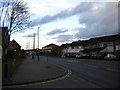
Grange Road, Alderman's Green
Looking north towards Victoria Farm estate from the junction with Hurst Road.
Image: © Richard Vince
Taken: 10 Nov 2012
0.07 miles
3
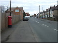
Grange Road
Showing position of Postbox No. CV6 110.
See Image] for postbox.
Image: © JThomas
Taken: 4 Mar 2017
0.13 miles
4
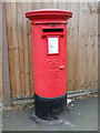
Elizabeth II postbox on Grange Road
Postbox No. CV6 110.
See Image] for context.
Image: © JThomas
Taken: 4 Mar 2017
0.13 miles
6

St Thomas the Apostle
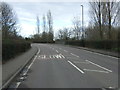
This church of Thomas the Apostle is the parish church of Longford & Hawkesbury. The church is on Longford Road close to the small shopping development of Longford Square.
Image: © Nigel Mykura
Taken: 13 Aug 2010
0.14 miles
7
Orchard House, Hurst Road, Longford, Coventry
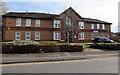
Managed by Midland Heart, Orchard House is retirement/sheltered housing containing 14 flats, built in 1990.
Image: © Jaggery
Taken: 19 Apr 2015
0.15 miles
8
Coventry: The Church of St Thomas the Apostle, Longford
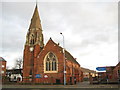
The church was completed in 1874 to the designs of John Cotton who was responsible for several other churches in the area. Until 1908 it was a chapel of ease within the Parish of Foleshill, but then the new Parish of Longford was created and St Thomas became the parish church. It is a Grade II Listed building by virtue of it being a 19th century church with streetscape presence on an historic arterial route, a well executed building by a renowned regional architect, and with fittings and glass mainly of the late 19th and early 20th centuries, with local connections such as the reredos, chancel glass and panelling.
The Church's website is here http://www.stthomaslongford.co.uk/index.html
Image: © Nigel Cox
Taken: 31 Dec 2011
0.17 miles
10
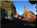
Longford Square, looking towards the parish church of St. Thomas
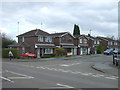
The hamlet of Longford, three miles north of Coventry, grew rapidly in the 1860s and 1870s as coal mining and textile industries developed in the area. The church of St. Thomas opened in 1874 as a chapel of ease of Foleshill parish, but later became a Church of England parish church in its own right. The building was designed by John Cotton of Birmingham. https://historicengland.org.uk/listing/the-list/list-entry/1076617 The three-storey building to the left has the distinctive shape of a row of ribbon weavers' houses. The large 'top shop' windows, providing light for the looms on the top floor, have been removed and smaller windows inserted, but their original size and shape can still be seen as brick infilling of a darker shade. Longford Road, which passes through the square in front of the church, is a main road between Coventry and Bedworth.
Image: © A J Paxton
Taken: 22 Oct 2020
0.17 miles