
IMAGES TAKEN NEAR TO
Burbages Lane, COVENTRY, CV6 6AX
Introduction
This page details the photographs taken nearby to Burbages Lane, CV6 6AX by members of the Geograph project.
The Geograph project started in 2005 with the aim of publishing, organising and preserving representative images for every square kilometre of Great Britain, Ireland and the Isle of Man.

There are currently over 7.5m images from over14,400 individuals and you can help contribute to the project by visiting https://www.geograph.org.uk
Image Map
Images are licensed for reuse under creativecommons.org/licenses/by-sa/2.0
Notes
- Clicking on the map will re-center to the selected point.
- The higher the marker number, the further away the image location is from the centre of the postcode.
Image Listing (34 Images Found)
Images are licensed for reuse under creativecommons.org/licenses/by-sa/2.0
Image
Details
Distance
1
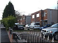
Flat-roofed houses, Burbages Lane
Burbages Lane contains a variety of different house designs, including several pairs of flat-roofed semi-detached houses like these.
Image: © Niki Walton
Taken: 4 May 2017
0.04 miles
2
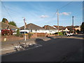
Bungalows, Burbages Lane
Amongst the variety of house styles in Burbages Lane are this short row of bungalows.
Image: © Niki Walton
Taken: 4 May 2017
0.05 miles
3
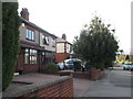
Semi-detached houses, Burbages Lane
Burbages Lane contains a variety of different house styles, including traditional semi-detached houses like these.
Image: © Niki Walton
Taken: 4 May 2017
0.05 miles
4
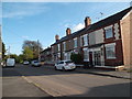
Terraced houses, Burbages Lane
Burbages Lane contains a variety of house styles, including this short run of terraced houses near the now-closed-off Coventry end.
Image: © Niki Walton
Taken: 4 May 2017
0.06 miles
5
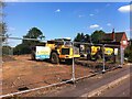
Construction begins at 'Springhill Gardens' site, Ash Green
The building site is seen here from Burbages Lane, July 2021. Bloor Homes are to build houses here. Where do they get these names from? The Hall Brook runs down one side of the site, alongside the drive to the long-vanished Barratt's Farm. Perhaps it rises from a spring on the hillside.
Image: © A J Paxton
Taken: 17 Jul 2021
0.10 miles
6
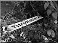
Lost in translation
This Welsh street sign has found its way into undergrowth near Ash Green on the outskirts of Coventry, over a hundred miles to the northeast of Ystradfellte. The proximity of Coventry Welsh Rugby Club, also in Ash Green, may have something to do with this.
Image: © A J Paxton
Taken: 30 May 2020
0.12 miles
7
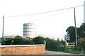
Beaurhys Border Collies and Foleshill Gas Tower
Foleshill Gas Tower looks in the background over Burbages Lane for one last day. Meanwhile, a dog breeding establishment advertises itself alongside horse manure for sale.
Image: © Niki Walton
Taken: 21 Sep 2002
0.14 miles
8
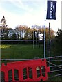
Springhill Gardens Coming Soon
Bloor Homes about to start infilling with houses one of the fields behind the ribbon development of Ash Green, April 2021.
Image: © A J Paxton
Taken: 25 Apr 2021
0.14 miles
9
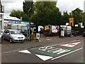
Bad Boys burger van at the Chana Car Centre, Ash Green
Bad Boys Burgers is in for servicing, maybe an MOT, at the Chana Car Centre on Wheelwright Lane, Ash Green, Bedworth. The SLOW sign reminds us, bad boys even, that we are near the gates of a primary school.
Image: © A J Paxton
Taken: 14 Aug 2021
0.15 miles
10
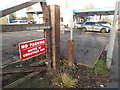
Gates in constant use
Given that there is direct access to the forecourt to the side, the gates appear to be in constant use as a fence rather than as gates.
Image: © Niki Walton
Taken: 29 Dec 2018
0.15 miles