IMAGES TAKEN NEAR TO
Shuckburgh Road, SOUTHAM, CV47 8NL
Introduction
This page details the photographs taken nearby to Shuckburgh Road, CV47 8NL by members of the Geograph project.
The Geograph project started in 2005 with the aim of publishing, organising and preserving representative images for every square kilometre of Great Britain, Ireland and the Isle of Man.

There are currently over 7.5m images from over14,400 individuals and you can help contribute to the project by visiting https://www.geograph.org.uk
Image Map (Loading...)


Getting Data...Please wait
Leaflet Map data © OpenStreetMap
Images are licensed for reuse under creativecommons.org/licenses/by-sa/2.0
Notes
- Clicking on the map will re-center to the selected point.
- The higher the marker number, the further away the image location is from the centre of the postcode.
Image Listing (8 Images Found)
Images are licensed for reuse under creativecommons.org/licenses/by-sa/2.0
Image
Details
Distance
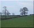
2
Entrance to Wigrams Turn Marina
Along Shuckburgh Road near Napton on the Hill. The marina is at Napton Junction on the Grand Union Canal and Oxford Canal.
Image: © Mat Fascione
Taken: 15 May 2015
0.06 miles
3
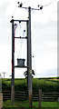
Transformer supplying Nightingale Farm, Napton
Image: © Andy F
Taken: 2 Aug 2009
0.15 miles
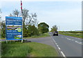
4
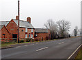
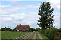
Roadside Cottage near Napton
Appropriately named Roadside Cottage, this cottage stands beside the A425 road at the entrance to Nightingale Farm east of Napton crossroads.
Image: © Andy F
Taken: 10 Jan 2009
0.17 miles
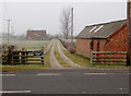
6
Nightingale Farm driveway, Napton
An August view; compare with the scene in winter [http://www.geograph.org.uk/photo/1114189] .
Image: © Andy F
Taken: 2 Aug 2009
0.20 miles
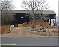
7
Nightingale Farm near Napton
Looking north from the A425 road up the drive to Nightingale Farm east of Napton crossroads.
Image: © Andy F
Taken: 10 Jan 2009
0.21 miles
8
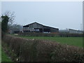
Nightingale Farm yard, Napton
Nightingale Farm's yard and barns are right beside the A425 road, east of Napton crossroads.
Image: © Andy F
Taken: 10 Jan 2009
0.21 miles