
IMAGES TAKEN NEAR TO
Napton Road, SOUTHAM, CV47 8HU
Introduction
This page details the photographs taken nearby to Napton Road, CV47 8HU by members of the Geograph project.
The Geograph project started in 2005 with the aim of publishing, organising and preserving representative images for every square kilometre of Great Britain, Ireland and the Isle of Man.

There are currently over 7.5m images from over14,400 individuals and you can help contribute to the project by visiting https://www.geograph.org.uk
Image Map
Images are licensed for reuse under creativecommons.org/licenses/by-sa/2.0
Notes
- Clicking on the map will re-center to the selected point.
- The higher the marker number, the further away the image location is from the centre of the postcode.
Image Listing (10 Images Found)
Images are licensed for reuse under creativecommons.org/licenses/by-sa/2.0
Image
Details
Distance
1
Southam to Tomlow bridleway (14 of 19)
The public bridleway and footpath from Southam to Tomlow follows the farm track north of the Stockton to Napton lane (seen in the foreground).
Previous photo in series: http://www.geograph.org.uk/photo/1099715
Next photo in series: http://www.geograph.org.uk/photo/1099732
Image: © Andy F
Taken: 30 Dec 2008
0.07 miles
2
Southam to Tomlow bridleway (12 of 19)
The public bridleway and footpath from Southam to Tomlow widens into this farm track as it approaches New Zealand Farm, Lower Tomlow.
Previous photo in series: http://www.geograph.org.uk/photo/1099708
Next photo in series: http://www.geograph.org.uk/photo/1099715
Image: © Andy F
Taken: 30 Dec 2008
0.10 miles
3
Southam to Tomlow bridleway (15 of 19)
This newly-built house, named Lakeside, stands beside the Southam to Tomlow public bridleway and footpath at Lower Tomlow on the Stockton to Napton lane.
Previous photo in series: http://www.geograph.org.uk/photo/1099721
Next photo in series: http://www.geograph.org.uk/photo/1099739
Image: © Andy F
Taken: 30 Dec 2008
0.11 miles
4
Stockton
Farmhouse and stables at point at which the Southam - Calcutt footpath crosses the Stockton - Napton road.
Image: © David Stowell
Taken: 11 Jun 2005
0.11 miles
5
Stockton Road Signs
Showing the road from Napton narrowing and bending.
Image: © Ian Rob
Taken: 2 Jun 2010
0.11 miles
6
Southam to Tomlow bridleway (13 of 19)
The public bridleway and footpath from Southam to Tomlow reaches New Zealand Farm and the lane from Stockton to Napton. The continuation of the bridleway across the lane can be seen at the right of this photo.
Previous photo in series: http://www.geograph.org.uk/photo/1099711
Next photo in series: http://www.geograph.org.uk/photo/1099721
Image: © Andy F
Taken: 30 Dec 2008
0.11 miles
7
Transformer supplying New Zealand Farm, Tomlow
Image: © Andy F
Taken: 1 Aug 2009
0.13 miles
8
Southam to Tomlow bridleway (16 of 19)
An impressive stand of trees east of the public bridleway and footpath from Southam to Tomlow.
Previous photo in series: http://www.geograph.org.uk/photo/1099732
Next photo in series: http://www.geograph.org.uk/photo/1099746
Image: © Andy F
Taken: 30 Dec 2008
0.21 miles
9
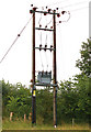
Transformer beside the Stockton to Napton lane
Image: © Andy F
Taken: 1 Aug 2009
0.22 miles
10
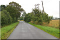
Looking southeast on the lane from Stockton to Napton
Image: © Andy F
Taken: 1 Aug 2009
0.23 miles