
IMAGES TAKEN NEAR TO
Ash Mews, SOUTHAM, CV47 2RU
Introduction
This page details the photographs taken nearby to Ash Mews, CV47 2RU by members of the Geograph project.
The Geograph project started in 2005 with the aim of publishing, organising and preserving representative images for every square kilometre of Great Britain, Ireland and the Isle of Man.

There are currently over 7.5m images from over14,400 individuals and you can help contribute to the project by visiting https://www.geograph.org.uk
Image Map
Images are licensed for reuse under creativecommons.org/licenses/by-sa/2.0
Notes
- Clicking on the map will re-center to the selected point.
- The higher the marker number, the further away the image location is from the centre of the postcode.
Image Listing (7 Images Found)
Images are licensed for reuse under creativecommons.org/licenses/by-sa/2.0
Image
Details
Distance
1
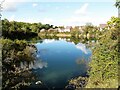
Bishop's Itchington-Blue Pool
One of several flooded quarries in the area. A new housing development is expanding on the site of the cement works.
Image: © Ian Rob
Taken: 1 Oct 2020
0.08 miles
2
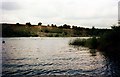
Blue Pool
One of the Bishops Bowl lakes, Bishop's Itchington, Warwickshire. Watersports venue for fishing, diving, canoeing, jetskiing, etc.
Image: © Lynne Kirton
Taken: Unknown
0.09 miles
3
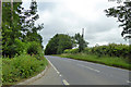
Road from Bishop's Itchington towards Harbury
The B4451.
Image: © Robin Webster
Taken: 24 Jun 2017
0.11 miles
4
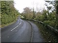
Bishop's Itchington
The B4451 road to Deppers Bridge winds uphill between the old flooded quarries.
Image: © Ian Rob
Taken: 23 Oct 2010
0.12 miles
5
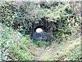
Bishop's Itchington-Bishop's Hill Nature Reserve
The overgrown and gated tunnel under the road which connected the large quarries to the Cement Works.
Image: © Ian Rob
Taken: 1 Oct 2020
0.13 miles
6
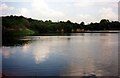
The Mitre Pool
One of the Bishops Bowl lakes, at Bishop's Itchington. Venue for watersports eg, fishing, diving, canoeing, & jetskiing.
Image: © Lynne Kirton
Taken: Unknown
0.17 miles
7

Bishops Bowl Lakes
One of the smaller pools close to Walworth Farm, looking down from Station Road.
Image: © Ian Rob
Taken: 23 Oct 2010
0.22 miles