IMAGES TAKEN NEAR TO
Ploughmans Holt, SOUTHAM, CV47 0EU
Introduction
This page details the photographs taken nearby to Ploughmans Holt, CV47 0EU by members of the Geograph project.
The Geograph project started in 2005 with the aim of publishing, organising and preserving representative images for every square kilometre of Great Britain, Ireland and the Isle of Man.

There are currently over 7.5m images from over14,400 individuals and you can help contribute to the project by visiting https://www.geograph.org.uk
Image Map (Loading...)


Getting Data...Please wait
Leaflet Map data © OpenStreetMap
Images are licensed for reuse under creativecommons.org/licenses/by-sa/2.0
Notes
- Clicking on the map will re-center to the selected point.
- The higher the marker number, the further away the image location is from the centre of the postcode.
Image Listing (6 Images Found)
Images are licensed for reuse under creativecommons.org/licenses/by-sa/2.0
Image
Details
Distance
1
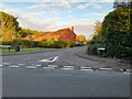
Merestone Close, Southam
From Coventry Street
Image: © David Howard
Taken: 17 Oct 2021
0.12 miles
3
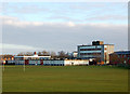
Southam School
Southam School, situated on Welsh Road West, is a comprehensive secondary which serves the town and a wide rural catchment in east Warwickshire.
Image: © Andy F
Taken: 2 Jan 2009
0.20 miles
4
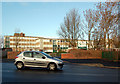
Southam School, front gates
The main entrance to Southam's comprehensive secondary school.
Image: © Andy F
Taken: 2 Jan 2009
0.20 miles
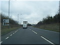
6
Footpath to Stockton from Southam
Looking east from Coventry Road at the start of a public footpath to Stockton.
Image: © Andy F
Taken: 17 May 2009
0.24 miles