
IMAGES TAKEN NEAR TO
Binton, STRATFORD-UPON-AVON, CV37 9UD
Introduction
This page details the photographs taken nearby to CV37 9UD by members of the Geograph project.
The Geograph project started in 2005 with the aim of publishing, organising and preserving representative images for every square kilometre of Great Britain, Ireland and the Isle of Man.

There are currently over 7.5m images from over14,400 individuals and you can help contribute to the project by visiting https://www.geograph.org.uk
Image Map
Images are licensed for reuse under creativecommons.org/licenses/by-sa/2.0
Notes
- Clicking on the map will re-center to the selected point.
- The higher the marker number, the further away the image location is from the centre of the postcode.
Image Listing (5 Images Found)
Images are licensed for reuse under creativecommons.org/licenses/by-sa/2.0
Image
Details
Distance
1
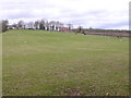
Hilltop Farm
As its name might suggest this farm is on top of a hill. In this case Wasen Hill. the south western end of Binton Hill. As with many "farms" in this area , it stopped being a working farm a long time ago and is now several large residences.
Image: © Nigel Mykura
Taken: 14 Apr 2013
0.03 miles
2
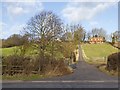
Driveway to Wasen Hill
The driveway off the B439 Evesham Road goes to Wasen Hill on the left and Hillside House on the right.
Image: © David P Howard
Taken: 4 Feb 2013
0.14 miles
3
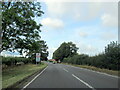
B439 Stratford Road at the Cranhill village sign
Image: © Roy Hughes
Taken: 23 Sep 2021
0.19 miles
4
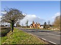
South Lodge, Evesham Road
Looking west along Evesham Road from opposite a lay-by, towards South Lodge.
Image: © David P Howard
Taken: 4 Feb 2013
0.20 miles
5
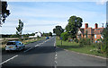
Cranhill
Looking west along the B439 near Cranhill. The lodge on the right was one of the entrances to Grafton Court
Image: © Dave Bushell
Taken: 29 Sep 2005
0.24 miles