
IMAGES TAKEN NEAR TO
Avon Bank Drive, STRATFORD-UPON-AVON, CV37 9SB
Introduction
This page details the photographs taken nearby to Avon Bank Drive, CV37 9SB by members of the Geograph project.
The Geograph project started in 2005 with the aim of publishing, organising and preserving representative images for every square kilometre of Great Britain, Ireland and the Isle of Man.

There are currently over 7.5m images from over14,400 individuals and you can help contribute to the project by visiting https://www.geograph.org.uk
Image Map
Images are licensed for reuse under creativecommons.org/licenses/by-sa/2.0
Notes
- Clicking on the map will re-center to the selected point.
- The higher the marker number, the further away the image location is from the centre of the postcode.
Image Listing (18 Images Found)
Images are licensed for reuse under creativecommons.org/licenses/by-sa/2.0
Image
Details
Distance
1
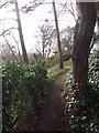
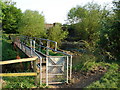
Riverside footpath, Stratford-on-Avon
Very narrow but picturesque strip between gardens and the river, steep in places.
Image: © Liz Stone
Taken: 8 Jan 2012
0.02 miles
2
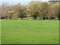
View to the river
A view across the meadow to the River Avon with the houses of Luddington Road behind. Seen from The Greenway, a footpath and bicycle track along the line of the dismantled Stratford-upon-Avon and Honeybourne branch of the former Great Western Railway.
Image: © Michael Dibb
Taken: 6 Nov 2011
0.07 miles
3
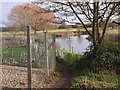
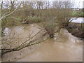
R. Avon below Luddington Road, Stratford-upon-Avon
Image: © Liz Stone
Taken: 8 Jan 2012
0.15 miles
4
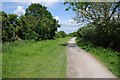
The Greenway approaching Stratford-upon-Avon
The Greenway cycleway follows the former Great Western Railway between Long Marston and Stratford-upon-Avon.
Image: © Philip Halling
Taken: 1 Jun 2014
0.17 miles
7
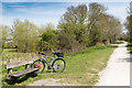
The Greenway
One of the many benches along the Greenway to stop and rest.
Stood by the bench is my new bicycle, a GT Traffic 1.0 hybrid, with 24 gears and hydraulic disc brakes, on its first Geograph outing.
Note the GPS60 on its handlebar mount.
Image: © David P Howard
Taken: 5 May 2016
0.19 miles
8
![River Stour [1]](https://s0.geograph.org.uk/geophotos/02/77/66/2776652_afdf8509_120x120.jpg)
River Stour [1]
The Greenway, part of the Monarch's Way long distance path, is a footpath and bicycle track along the line of the dismantled Great Western Railway. It crosses the River Stour, seen here looking north from the bridge. The River Stour flows into the River Avon just 400 yards downstream.
Image: © Michael Dibb
Taken: 6 Nov 2011
0.19 miles
9
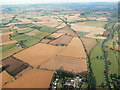
Disused railway line from Stratford-upon-Avon to Honeybourne
Aerial photograph. River Avon to right of line in this image. Railway was the ex-GWR route from Stratford-upon-Avon to Cheltenham via Honeybourne.
Image: © Barry Bolland
Taken: 31 Jul 2015
0.19 miles
10
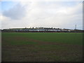
View towards Bordon Hill
Looking north from the road to Luddington with the rooftops of Bordon Hill Nurseries beyond the hedge and in the distance in the next square, Bordon Hill itself.
Image: © David Stowell
Taken: 15 Feb 2006
0.19 miles