IMAGES TAKEN NEAR TO
Jargonelle Place, STRATFORD-UPON-AVON, CV37 9GH
Introduction
This page details the photographs taken nearby to Jargonelle Place, CV37 9GH by members of the Geograph project.
The Geograph project started in 2005 with the aim of publishing, organising and preserving representative images for every square kilometre of Great Britain, Ireland and the Isle of Man.

There are currently over 7.5m images from over14,400 individuals and you can help contribute to the project by visiting https://www.geograph.org.uk
Image Map
Images are licensed for reuse under creativecommons.org/licenses/by-sa/2.0
Notes
- Clicking on the map will re-center to the selected point.
- The higher the marker number, the further away the image location is from the centre of the postcode.
Image Listing (5 Images Found)
Images are licensed for reuse under creativecommons.org/licenses/by-sa/2.0
Image
Details
Distance
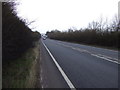
3
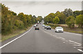
A46 runs straight near Stratford-Upon-Avon
Having just crossed the Stratford-Upon-Avon Canal.
Image: © J.Hannan-Briggs
Taken: 13 Oct 2016
0.11 miles
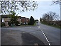
5

Broadmeadow Lane
Houses on Broadmeadow Lane off Bishopton Lane in Stratford-upon-Avon.
Image: © Philip Halling
Taken: 3 Aug 2019
0.16 miles