
IMAGES TAKEN NEAR TO
Old Brewery Field, STRATFORD-UPON-AVON, CV37 8ZD
Introduction
This page details the photographs taken nearby to Old Brewery Field, CV37 8ZD by members of the Geograph project.
The Geograph project started in 2005 with the aim of publishing, organising and preserving representative images for every square kilometre of Great Britain, Ireland and the Isle of Man.

There are currently over 7.5m images from over14,400 individuals and you can help contribute to the project by visiting https://www.geograph.org.uk
Image Map
Images are licensed for reuse under creativecommons.org/licenses/by-sa/2.0
Notes
- Clicking on the map will re-center to the selected point.
- The higher the marker number, the further away the image location is from the centre of the postcode.
Image Listing (14 Images Found)
Images are licensed for reuse under creativecommons.org/licenses/by-sa/2.0
Image
Details
Distance
1
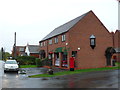
Post Office Long Marston
This post office in a modern semi detached building with a house in the other half is also the village shop. there is also a flat above the post office.
Image: © Nigel Mykura
Taken: 28 Oct 2012
0.07 miles
2
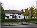
Masons Arms
This old public house is in the centre of the village opposite the village store and post office.
Image: © Nigel Mykura
Taken: 28 Oct 2012
0.10 miles
3
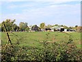
Farm buildings, The Goodwins
View west from The Greenway cycle path towards a property marked on the map as The Goodwins. The timber framed barn to the left of centre looks interesting.
Image: © David P Howard
Taken: 2 Oct 2011
0.13 miles
4
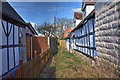
Heart of England Way
The Heart of England Way long distance footpath runs between some cottages on the way out of Long Marston towards Dorsington.
Image: © David P Howard
Taken: 17 Feb 2015
0.14 miles
5
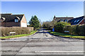
Wyre Lane, Long Marston
The junction of Wyre Lane and Welford Road.
The long distance path, the Heart of England Way follows Wyre Lane as it heads east out of Long Marston.
Image: © David P Howard
Taken: 17 Feb 2015
0.16 miles
6
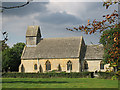
Long Marston Church
The Parish Church of St James at Long Marston, formerly Marston Sicca. Looking north. The parish was transferred from Gloucestershire to Warwickshire in 1931.
Image: © Dave Bushell
Taken: 20 Sep 2005
0.17 miles
7
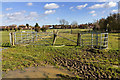
Heart of England Way
Kissing gates on the Heart of England Way long distance footpath as it approaches Long Marston.
The going underfoot was very wet and muddy on this day.
Image: © David P Howard
Taken: 17 Feb 2015
0.20 miles
8
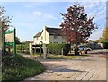
Wyre Lane Crossing on The Greenway
Wyre Lane crosses The Greenway cycle path. In the background are Railway Cottages, a reference to the cycle path being along the track bed of the old GWR Stratford to Cheltenham railway.
Image: © David P Howard
Taken: 2 Oct 2011
0.23 miles
9
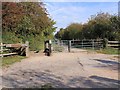
Wyre Lane Crossing on The Greenway
Wyre Lane crosses The Greenway cycle path. Users are faced with a variety of obstacles at various points along the path. Here typically are a horse step on the left, which most cyclists use to lift their bikes over; a kissing gate in the middle for pedestrians; and a large locked gate on the right, presumably for service vehicles.
Image: © David P Howard
Taken: 2 Oct 2011
0.23 miles
10
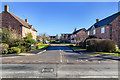
The Brickall, Long Marston
A new housing development off Welford Road.
Image: © David P Howard
Taken: 17 Feb 2015
0.23 miles