
IMAGES TAKEN NEAR TO
Wellington Avenue, STRATFORD-UPON-AVON, CV37 8WB
Introduction
This page details the photographs taken nearby to Wellington Avenue, CV37 8WB by members of the Geograph project.
The Geograph project started in 2005 with the aim of publishing, organising and preserving representative images for every square kilometre of Great Britain, Ireland and the Isle of Man.

There are currently over 7.5m images from over14,400 individuals and you can help contribute to the project by visiting https://www.geograph.org.uk
Image Map
Images are licensed for reuse under creativecommons.org/licenses/by-sa/2.0
Notes
- Clicking on the map will re-center to the selected point.
- The higher the marker number, the further away the image location is from the centre of the postcode.
Image Listing (11 Images Found)
Images are licensed for reuse under creativecommons.org/licenses/by-sa/2.0
Image
Details
Distance
1
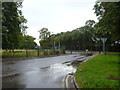
Now a business park
This is the main entrance to the former Central Engineer Park, now Long Marston Business Park. Central Engineer Park was formerly a very large storage depot for the MOD comprising 478 acres with 1.4 million sq ft of workshops, storage and office accommodation and 35 kilometres of rail line. The Park was opened in 1941 and by the end of the war a major hutted camp had been established. Further construction took place including barrack blocks and offices during the 1960s. Sold off by the MOD, part of the site is now used by private businesses and there plans to create a sustainable community with housing and leisure facilities.
Image: © Michael Dibb
Taken: 5 Aug 2012
0.01 miles
2

Space to let
This notice stands outside the main entrance to Long Marston Business Park, formerly the MOD's Central Engineer Park. See Image
Image: © Michael Dibb
Taken: 5 Aug 2012
0.03 miles
3
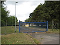
Entrance to Long Marston storage depot
Entrance to Long Marston storage depot from the B4632.
Image: © Philip Halling
Taken: 24 Jul 2010
0.17 miles
4
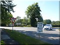
Hand Car Wash
This sign advetises the service at a T junction just outside Lower Quinton on the B4632 Mickleton to Stratford road.
Image: © Nigel Mykura
Taken: 24 Jul 2011
0.17 miles
5
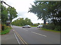
Country junction
The road from Lower Quinton meets the B4632 (formerly the A46). Behind the camera to Mickleton, straight ahead to Stratford-upon-Avon.
Image: © Michael Dibb
Taken: 5 Aug 2012
0.18 miles
6
![Across the road [1]](https://s3.geograph.org.uk/geophotos/03/11/37/3113715_e53492ce_120x120.jpg)
Across the road [1]
The footpath from Upper Quinton to the B4632 crosses Main Road. This view is looking towards the B4632. The gap in the hedge looks a little overgrown.
Image: © Michael Dibb
Taken: 5 Aug 2012
0.21 miles
7
![Across the road [2]](https://s0.geograph.org.uk/geophotos/03/11/37/3113724_f95c4490_120x120.jpg)
Across the road [2]
The footpath from Upper Quinton to the B4632 crosses Main Road. This view is looking towards Upper Quinton. Meon Hill is in the distance. The gap in the hedge looks a little overgrown.
Image: © Michael Dibb
Taken: 5 Aug 2012
0.22 miles
8
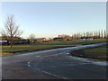
Long Marston storage depot
Disused Railway rolling stock at Long Marston storage depot
Image: © Paul Rudge
Taken: 17 Dec 2008
0.22 miles
9
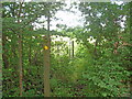
Path junction
From the footpath running alongside Campden Road (B4632), a footpath branches off leading to Upper Quinton and Meon Hill. The other end of the path is at Image
Image: © Michael Dibb
Taken: 5 Aug 2012
0.22 miles
10
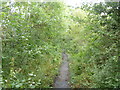
Off road footpath
The footpath that runs alongside Campden Road (B4632) is separated from the road which is behind the trees to the left of the image.
Image: © Michael Dibb
Taken: 5 Aug 2012
0.24 miles