
IMAGES TAKEN NEAR TO
Upper Quinton, STRATFORD-UPON-AVON, CV37 8SX
Introduction
This page details the photographs taken nearby to CV37 8SX by members of the Geograph project.
The Geograph project started in 2005 with the aim of publishing, organising and preserving representative images for every square kilometre of Great Britain, Ireland and the Isle of Man.

There are currently over 7.5m images from over14,400 individuals and you can help contribute to the project by visiting https://www.geograph.org.uk
Image Map
Images are licensed for reuse under creativecommons.org/licenses/by-sa/2.0
Notes
- Clicking on the map will re-center to the selected point.
- The higher the marker number, the further away the image location is from the centre of the postcode.
Image Listing (18 Images Found)
Images are licensed for reuse under creativecommons.org/licenses/by-sa/2.0
Image
Details
Distance
1
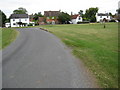
Houses in Upper Quinton
Houses overlooking the Green in Upper Quinton.
Image: © Philip Halling
Taken: 24 Jul 2010
0.04 miles
4
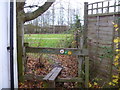
Into the fields
After passing between houses, the footpath, the combined Monarch's Way and Centenary Way, passes over this stile and out into open fields.
Image: © Michael Dibb
Taken: 4 Dec 2011
0.10 miles
5
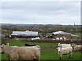
Old Bakery Farm
This wonderfully named farm is seen from the footpath that is the combined Monarch's Way and Centenary Way. The houses in the distance are in Lower Quinton and the spire is that of the church of St Swithin. The young cattle were, as ever, curious and skittish.
Image: © Michael Dibb
Taken: 4 Dec 2011
0.10 miles
6
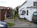
The start of the way
This point marks the start of the Warwickshire Centenary Way footpath. Created to mark 100 years of Warwickshire County Council, this 98 mile long distance path runs from Upper Quinton to Kingsbury Water Park alongside the M42 near Sutton Coldfield. The footpath is also part of the Monarch's Way, a 615 mile long path which runs from Powick Bridge, Worcester to Shoreham-by-Sea, West Sussex.
Image: © Michael Dibb
Taken: 4 Dec 2011
0.10 miles
7
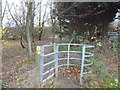
Into the woodland
The footpath, the combined Monarch's Way and Centenary Way, enters a small patch of woodland
Image: © Michael Dibb
Taken: 4 Dec 2011
0.13 miles
8
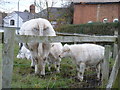
White cattle
These two youngsters with their mother are in a small field alongside Hill Lane in Upper Quinton.
Image: © Michael Dibb
Taken: 4 Dec 2011
0.14 miles
9
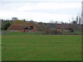
Falling down
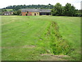
Seen from the footpath, part of The Heart of England Way, this group of farm buildings has clearly seen better days.
Image: © Michael Dibb
Taken: 4 Dec 2011
0.14 miles
10
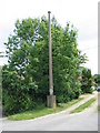
Vent pipe, Upper Quinton
One of several reinforced concrete sewer vent pipes in this area.
Image: © David Stowell
Taken: 4 Jun 2006
0.15 miles