
IMAGES TAKEN NEAR TO
Alderminster, STRATFORD-UPON-AVON, CV37 8BW
Introduction
This page details the photographs taken nearby to CV37 8BW by members of the Geograph project.
The Geograph project started in 2005 with the aim of publishing, organising and preserving representative images for every square kilometre of Great Britain, Ireland and the Isle of Man.

There are currently over 7.5m images from over14,400 individuals and you can help contribute to the project by visiting https://www.geograph.org.uk
Image Map
Images are licensed for reuse under creativecommons.org/licenses/by-sa/2.0
Notes
- Clicking on the map will re-center to the selected point.
- The higher the marker number, the further away the image location is from the centre of the postcode.
Image Listing (11 Images Found)
Images are licensed for reuse under creativecommons.org/licenses/by-sa/2.0
Image
Details
Distance
1
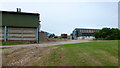
Whitehill Farm
Diverse rural business near Alderminster; viewed from the footpath.
Note this is the eighth geograph from eight different contributors to this square.
Image: © Jonathan Billinger
Taken: 27 Jun 2012
0.07 miles
2
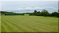
Looking towards Loxley
Land east of Whitehill Farm near Alderminster.
Image: © Jonathan Billinger
Taken: 27 Jun 2012
0.16 miles
3
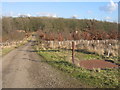
Beecham Spinney
Looking east towards Beecham Farm. The area has good views to the north and south and is dotted with the remains of military buildings associated with the WWII Stratford Airfield, some of which can be seen in the trees in the middle distance.
Image: © David Stowell
Taken: 10 Feb 2006
0.20 miles
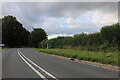
5
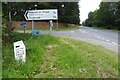
Road to Preston on Stour
Road junction on the A3400 near Preston on Stour. A milepost can be seen to the left Image
Image: © Philip Halling
Taken: 17 Jul 2023
0.21 miles
6
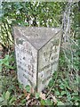
Old Milepost by the A3400, Alderminster
Cast iron post by the A3400 (was A34), in parish of Alderminster (Stratford on Avon District), South East corner of Alscot Park, at turn to Preston on Stour, on wide grass verge by sign post, on South-West side of road. Erected by the County Council in the 19th century.
Inscription reads:-
: {hand pointing right} / STRATFORD / 3¼ MILES / HENLEY 11¼ / BIRMINGHAM 26½ : : ALDERMINSTER / PARISH : : {hand pointing left} / SHIPSTON / 7 MILES / CHIPPING NORTON 17½ / OXFORD 35 :
Grade II listed. List Entry Number: 1382539
https://historicengland.org.uk/listing/the-list/list-entry/1382539
Milestone Society National ID: WA_SFOX03.
Image: © Milestone Society
Taken: 6 Oct 2017
0.21 miles
7
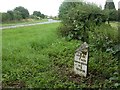
Alderminster, milepost
At the junction of Shipston Road & Preston Lane; cast-iron, V-shaped. Distances on the far side are to Stratford, Henley & Birmingham; on the bevel is the parish name, Alderminster. Listed by English Heritage, http://www.imagesofengland.org.uk/Details/default.aspx?pid=2&id=482923
Image: © Mike Faherty
Taken: 11 Jul 2009
0.22 miles

9
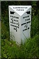
Milepost at Alderminster
This milepost beside the A3400 has been refurbished since it was photographed in 2017 Image
Image: © Philip Halling
Taken: 17 Jul 2023
0.22 miles
10

Entrance to Alscot Park
Lodges and gates at the entrance to Alscot Park, looking west from the A3400.
Image: © Dave Bushell
Taken: 3 Oct 2005
0.23 miles