
IMAGES TAKEN NEAR TO
Alveston Hill, STRATFORD-UPON-AVON, CV37 7RW
Introduction
This page details the photographs taken nearby to Alveston Hill, CV37 7RW by members of the Geograph project.
The Geograph project started in 2005 with the aim of publishing, organising and preserving representative images for every square kilometre of Great Britain, Ireland and the Isle of Man.

There are currently over 7.5m images from over14,400 individuals and you can help contribute to the project by visiting https://www.geograph.org.uk
Image Map
Images are licensed for reuse under creativecommons.org/licenses/by-sa/2.0
Notes
- Clicking on the map will re-center to the selected point.
- The higher the marker number, the further away the image location is from the centre of the postcode.
Image Listing (7 Images Found)
Images are licensed for reuse under creativecommons.org/licenses/by-sa/2.0
Image
Details
Distance
2
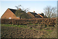
Three bungalows on Alveston Hill
Across the lane from Alveston Hill Farm No 1.
Image: © Robin Stott
Taken: 6 Mar 2011
0.08 miles
4

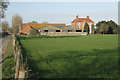
'Willow Farm', Alveston Hill
It appears to be more a residential than a working farm. Out of sight down the hill are two long buildings, perhaps battery houses. In the distance across the valley is the northwest edge of the Feldon countryside around Loxley.
Image: © Robin Stott
Taken: 6 Mar 2011
0.13 miles
5
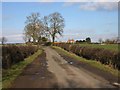
View North up the lane to Tiddington
View north up the lane with Alveston Hill Farm No 1 in the distance in the next square.
Image: © David P Howard
Taken: 20 Feb 2010
0.17 miles
6
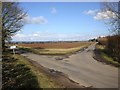
Junction of Knights Lane and Pimlico Lane, Alveston Hill
View North over the junction.
Image: © David P Howard
Taken: 20 Feb 2010
0.19 miles
7
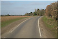
Continuous passing place, Alveston Hill
Pimlico Lane over Alveston Hill is defined by white lines as a single-carriageway road. Wide verges allow vehicles to pass over a considerable length: a disfiguring feature of this landscape.
Image: © Robin Stott
Taken: 6 Mar 2011
0.19 miles