
IMAGES TAKEN NEAR TO
Mulberry Street, STRATFORD-UPON-AVON, CV37 6RS
Introduction
This page details the photographs taken nearby to Mulberry Street, CV37 6RS by members of the Geograph project.
The Geograph project started in 2005 with the aim of publishing, organising and preserving representative images for every square kilometre of Great Britain, Ireland and the Isle of Man.

There are currently over 7.5m images from over14,400 individuals and you can help contribute to the project by visiting https://www.geograph.org.uk
Image Map
Images are licensed for reuse under creativecommons.org/licenses/by-sa/2.0
Notes
- Clicking on the map will re-center to the selected point.
- The higher the marker number, the further away the image location is from the centre of the postcode.
Image Listing (690 Images Found)
Images are licensed for reuse under creativecommons.org/licenses/by-sa/2.0
Image
Details
Distance
1
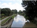
The Stratford upon Avon Canal
Seen as it descends the last locks that take it discreetly around the north and east of the town before emerging into the full glare of tourists at Bancroft Basin in front of the RSC Theatre and the River Avon.
Image: © David Stowell
Taken: 7 Aug 2005
0.00 miles
2
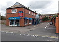
The Electric Shop, Stratford-upon-Avon
Viewed across Mulberry Street.
Image: © Jaggery
Taken: 24 Aug 2014
0.01 miles
3
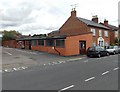
Polo Market Shop, Stratford-upon-Avon
In single-storey premises set back from Mulberry Street.
Image: © Jaggery
Taken: 24 Aug 2014
0.02 miles
4
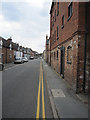
Great William Street
Looking south west along Great William Street, not far from Maidenhead Bridge. There is a bench mark on the brick pier on the right - Image
Image: © John S Turner
Taken: 1 Aug 2011
0.03 miles
5
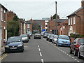
Mulberry Street
Late 19th century development just to the north of the town centre.
Image: © Alan Murray-Rust
Taken: 6 Mar 2011
0.03 miles
6
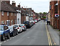
Great William Street in Stratford-upon-Avon
Image: © Mat Fascione
Taken: 4 May 2015
0.03 miles
7
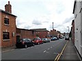
Mulberry Street, Stratford-upon-Avon
Viewed from the corner of Shakespeare Street looking towards Great William Street.
Image: © Jaggery
Taken: 24 Aug 2014
0.03 miles
8

Bench mark alongside Great William Street
This bench mark is on a brick pier outside what seems to be an old warehouse redeveloped for housing. The mark was recorded on the 1886 Town Plans levelled at 138.2 feet. See also Image
Image: © John S Turner
Taken: 1 Aug 2011
0.03 miles
9
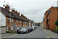
Great William Street in Stratford-upon-Avon, Warwickshire
This road is seen from the bridge over the canal. Behind the camera the road is named Maidenhead Road.
Image: © Roger D Kidd
Taken: 24 Aug 2012
0.04 miles
10
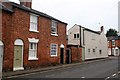
Mulberry Street
A family ancestor lived at no. 5 in 1891
Image: © Graham Hogg
Taken: 2 Apr 2014
0.04 miles