
IMAGES TAKEN NEAR TO
Underhill Close, COVENTRY, CV3 6RB
Introduction
This page details the photographs taken nearby to Underhill Close, CV3 6RB by members of the Geograph project.
The Geograph project started in 2005 with the aim of publishing, organising and preserving representative images for every square kilometre of Great Britain, Ireland and the Isle of Man.

There are currently over 7.5m images from over14,400 individuals and you can help contribute to the project by visiting https://www.geograph.org.uk
Image Map
Images are licensed for reuse under creativecommons.org/licenses/by-sa/2.0
Notes
- Clicking on the map will re-center to the selected point.
- The higher the marker number, the further away the image location is from the centre of the postcode.
Image Listing (40 Images Found)
Images are licensed for reuse under creativecommons.org/licenses/by-sa/2.0
Image
Details
Distance
3
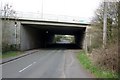
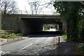
Junction with the A46 main carriageway
A parapet for the minor road which passes underneath can be seen on the right.
Image: © Peter Whatley
Taken: 3 Apr 2012
0.06 miles
4
A46 near Baginton
Heading south west out of Coventry.
Image: © J.Hannan-Briggs
Taken: 13 Oct 2016
0.06 miles
5
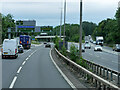
A46 Kenilworth Bypass approaching Stivichall Interchange
Stivichall Interchange, also known as Festival Island, is a junction on the A46 Kenilworth Bypass, where it intersects with the A45 Coventry Bypass. The junction was built in the 1970s at the same time as the A46..
Image: © David Dixon
Taken: 31 May 2024
0.07 miles
7
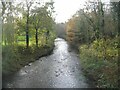
River Sowe
Looking downstream on the river Sowe from Baginton Bridge on Mill Hill. This section of the river's course was straightened with the building of the A46, to the right, in the 1970s.
Image: © E Gammie
Taken: 6 Nov 2020
0.08 miles
8
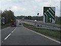
Joining the southbound A46
The view from the slip road from Stivichall junction's roundabout.
Image: © Peter Whatley
Taken: 3 Apr 2012
0.09 miles
10

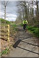
Baginton Bridge
Looking downstream towards the sandstone ashlar bridge dating from the 18th century crossing the river Sowe.
Image: © E Gammie
Taken: 6 Nov 2020
0.10 miles