
IMAGES TAKEN NEAR TO
Rowlands Way, SHIPSTON-ON-STOUR, CV36 5ES
Introduction
This page details the photographs taken nearby to Rowlands Way, CV36 5ES by members of the Geograph project.
The Geograph project started in 2005 with the aim of publishing, organising and preserving representative images for every square kilometre of Great Britain, Ireland and the Isle of Man.

There are currently over 7.5m images from over14,400 individuals and you can help contribute to the project by visiting https://www.geograph.org.uk
Image Map
Images are licensed for reuse under creativecommons.org/licenses/by-sa/2.0
Notes
- Clicking on the map will re-center to the selected point.
- The higher the marker number, the further away the image location is from the centre of the postcode.
Image Listing (44 Images Found)
Images are licensed for reuse under creativecommons.org/licenses/by-sa/2.0
Image
Details
Distance
1
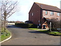
Start of path
The footpath, part of the Centenary Way, starts here where it leaves the road.
Image: © Michael Dibb
Taken: 3 Mar 2012
0.01 miles
2
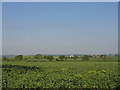
View from The Leys
Looking east across the almost flat farmland in this square with Kirby Farm visible in the distance.
Image: © David Stowell
Taken: 2 Jun 2006
0.02 miles
3
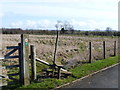
Into open fields
After passing between houses, the footpath crosses this field of rough pasture. Part of the Centenary Way, the path leads to Upper Tysoe.
Image: © Michael Dibb
Taken: 3 Mar 2012
0.02 miles
4
![Lower Farm [1]](https://s2.geograph.org.uk/geophotos/02/91/86/2918682_6471e338_120x120.jpg)
Lower Farm [1]
The farm buildings are seen from the road.
Image: © Michael Dibb
Taken: 3 Mar 2012
0.05 miles
5
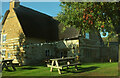
Royal Oak, Whatcote
Also shown at https://www.geograph.org.uk/search.php?i=203947073 . Listed and described at https://historicengland.org.uk/listing/the-list/list-entry/1186080?section=official-list-entry .
Image: © Derek Harper
Taken: 4 Nov 2022
0.06 miles
6
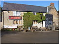
The Royal Oak
Dating back to the 17th century, this public house is listed grade II. More details at: http://www.britishlistedbuildings.co.uk/en-305934-the-royal-oak-public-house-whatcote
Image: © Michael Dibb
Taken: 3 Mar 2012
0.06 miles
7
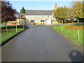
Junction of roads in Whatcote
Looking north-westward with The Royal Oak directly ahead.
Image: © Peter Wood
Taken: 5 Nov 2017
0.06 miles
8
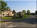
The Leys, Whatcote
Modern housing beside the road entering the village from Oxhill.
Image: © David Stowell
Taken: 2 Jun 2006
0.06 miles
9
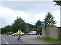
Cyclist passing the Royal Oak
This village pub stand right on the main road junction in the centre of this small village. The pub sign shows two roundheadd standing guard with an oak tree and crown behind them.
Image: © Nigel Mykura
Taken: 23 Jun 2013
0.06 miles
10
![Lower Farm [2]](https://s0.geograph.org.uk/geophotos/02/91/86/2918688_b6dedfef_120x120.jpg)
Lower Farm [2]
The farm buildings are seen from the road. The house in the background is The Barn House.
Image: © Michael Dibb
Taken: 3 Mar 2012
0.07 miles