
IMAGES TAKEN NEAR TO
Orchard View, SHIPSTON-ON-STOUR, CV36 5AP
Introduction
This page details the photographs taken nearby to Orchard View, CV36 5AP by members of the Geograph project.
The Geograph project started in 2005 with the aim of publishing, organising and preserving representative images for every square kilometre of Great Britain, Ireland and the Isle of Man.

There are currently over 7.5m images from over14,400 individuals and you can help contribute to the project by visiting https://www.geograph.org.uk
Image Map
Images are licensed for reuse under creativecommons.org/licenses/by-sa/2.0
Notes
- Clicking on the map will re-center to the selected point.
- The higher the marker number, the further away the image location is from the centre of the postcode.
Image Listing (23 Images Found)
Images are licensed for reuse under creativecommons.org/licenses/by-sa/2.0
Image
Details
Distance
1
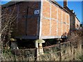
High off the ground
This former grain store is raised off the ground as it sits on staddle stones.
Image: © Michael Dibb
Taken: 17 Jan 2010
0.03 miles
2
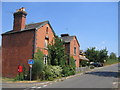
Burmington
A couple of estate houses beside the main road through the village that seem to have seen better days.
Image: © David Stowell
Taken: 19 Jul 2006
0.04 miles
3
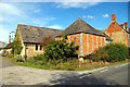
Raised granary
Old staddle stones used as ornaments are a common sight in country districts, but it is rare to find them still in their original position as in this timber-framed granary with brick infilling, where their purpose is to support the structure clear of the ground and out of the reach of vermin. For more detail see Image (I see that honey is no longer for sale!)
Image: © Tiger
Taken: 20 Aug 2011
0.05 miles
4
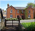
Burmington Main Street
Cottages opposite the Church.
Image: © Ian Rob
Taken: 15 May 2019
0.06 miles
5
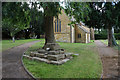
Remains of a preaching cross
The cross is in the churchyard of St Barnabas & St Nicholas, Burmington. Both the cross and the church are Grade II listed. The listing details of the cross are here: https://britishlistedbuildings.co.uk/101299745-church-of-st-barnabas-and-st-nicholas-base-of-cross-approximately-10-metres-north-east-of-church-burmington#.XzmhyehKhPY.
Image: © Bill Boaden
Taken: 7 Aug 2020
0.06 miles
6
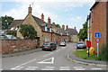
The Lane
A residential road in Burmington.
Image: © Bill Boaden
Taken: 7 Aug 2020
0.06 miles
7
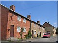
Houses by Burmington Farm
This row of houses are close to the southern edge of the square by the lane leading to Burmington Farm.
Image: © David Stowell
Taken: 19 Jul 2006
0.06 miles
8
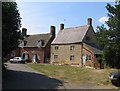
Burmington
Some of the cottages in the small corner of this village that spreads into the south of this square.
Image: © David Stowell
Taken: 19 Jul 2006
0.06 miles
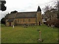
10
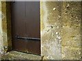
Benchmark on church
This bench mark was established between 1850 and 1856 during the First primary levelling of England & Wales, and was levelled with a height of 267.2830 feet [81.4679 metres] above mean sea level (Liverpool datum). It was included on the Basingstoke to Coventry levelling line. The surveyor's description was "No. 159. Bolt in North side of Burmington Church tower ; 2.15 ft. above surface" (Public Abstract p.239).
Image: © Shantavira
Taken: 10 Oct 2015
0.08 miles