
IMAGES TAKEN NEAR TO
Torigni Avenue, SHIPSTON-ON-STOUR, CV36 4RH
Introduction
This page details the photographs taken nearby to Torigni Avenue, CV36 4RH by members of the Geograph project.
The Geograph project started in 2005 with the aim of publishing, organising and preserving representative images for every square kilometre of Great Britain, Ireland and the Isle of Man.

There are currently over 7.5m images from over14,400 individuals and you can help contribute to the project by visiting https://www.geograph.org.uk
Image Map
Images are licensed for reuse under creativecommons.org/licenses/by-sa/2.0
Notes
- Clicking on the map will re-center to the selected point.
- The higher the marker number, the further away the image location is from the centre of the postcode.
Image Listing (12 Images Found)
Images are licensed for reuse under creativecommons.org/licenses/by-sa/2.0
Image
Details
Distance
1
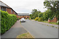
Railway Crescent
Newer housing on the north side of Shipston-on-Stour.
Image: © Bill Boaden
Taken: 7 Aug 2020
0.13 miles
3

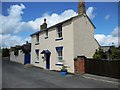
Station Road, Shipston-on-Stour
As the name suggests, there was once a railway station somewhere round here.
Image: © Bill Boaden
Taken: 7 Aug 2020
0.15 miles
4
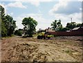
Site of former Shipston-on-Stour station
Shipston-on-Stour was served by a railway line to Moreton-in-Marsh. The station was closed in May 1960 and later demolished apart from the weighbridge office seen on the right behind the wall. This photograph was taken in May 2001.
Image: © graham ross
Taken: 31 May 2001
0.15 miles
5
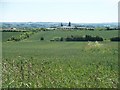
Crops and industry
Looking across the rich farmland to the Shipston Industrial Estate on Darlingscote Road. Margett's Hill Image in the distance.
Image: © Michael Dibb
Taken: 22 Jun 2010
0.16 miles
6
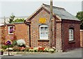
Former railway weighbridge office at Shipston-on-Stour
This is the only building surviving from the former railway station. It is now in the grounds of a residential property.
Image: © graham ross
Taken: 31 May 2001
0.18 miles
7
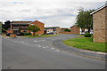
Mayo Road
Part of the northern housing expansion of Shipston-on-Stour.
Image: © Bill Boaden
Taken: 7 Aug 2020
0.19 miles
9

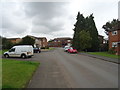
Houses on Badgers Crescent, Shipston-on-Stour
Image: © JThomas
Taken: 5 Oct 2019
0.21 miles
10

Shipston on Stour, Black Horse Inn
Thatched public house on Station Road; three rooms, with off-sales counter in between, open fireplaces, wooden beams, exposed stonework and stone flags; patio and gazebo outside. Three cask ales on offer at my visit. The C17 building is listed by Historic England: http://www.imagesofengland.org.uk/Details/Default.aspx?id=306514&mode=adv
Image: © Mike Faherty
Taken: 28 Jul 2017
0.23 miles