
IMAGES TAKEN NEAR TO
Lowes Lane, WARWICK, CV35 9TU
Introduction
This page details the photographs taken nearby to Lowes Lane, CV35 9TU by members of the Geograph project.
The Geograph project started in 2005 with the aim of publishing, organising and preserving representative images for every square kilometre of Great Britain, Ireland and the Isle of Man.

There are currently over 7.5m images from over14,400 individuals and you can help contribute to the project by visiting https://www.geograph.org.uk
Image Map
Images are licensed for reuse under creativecommons.org/licenses/by-sa/2.0
Notes
- Clicking on the map will re-center to the selected point.
- The higher the marker number, the further away the image location is from the centre of the postcode.
Image Listing (129 Images Found)
Images are licensed for reuse under creativecommons.org/licenses/by-sa/2.0
Image
Details
Distance
1
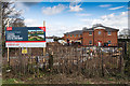
New housing at Orchard Court
Work has started on the new housing development. Most of the trees and vegetation within and around the edge of the site have been cut down, and the foundations of the new houses are in already.
Image: © David P Howard
Taken: 5 Apr 2016
0.02 miles
2

New housing at Orchard Court
Work has started on the new housing development. Most of the trees and vegetation within and around the edge of the site have been cut down, and the foundations of the new houses are in already.
Image: © David P Howard
Taken: 5 Apr 2016
0.02 miles
3
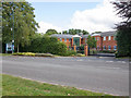
Equidebt (In Administration)
This building on the edge of Wellesbourne village was the offices of Equidebt Ltd. who went into administration in June 2013 with the loss of 60 plus jobs.
Equidebt specialised in the collection of consumer debt, comprising both its own debts, as a debt purchaser, and the collection of debts on behalf of third parties. (Text from article in Stratford Herald local newspaper).
Image: © David P Howard
Taken: 8 Sep 2013
0.03 miles
4
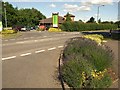
Ettington Road, Wellesbourne
Junctions on the Ettington Road. On the far side is the entrance to a Co-op supermarket. In the foreground is a bed of lavender.
Image: © Derek Harper
Taken: 11 Jun 2011
0.04 miles
5

Poppies by the roadside
A bank of poppies by the side of the A429 on the outskirts of Wellesbourne.
Image: © David P Howard
Taken: 5 Jun 2014
0.04 miles
6
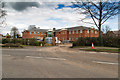
New housing at Orchard Court
Work has started on the new housing development. Most of the trees and vegetation within and around the edge of the site have been cut down, and the foundations of the new houses are in already.
Image: © David P Howard
Taken: 5 Apr 2016
0.04 miles
7
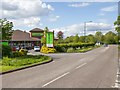
The Co-operative Food supermarket off Ettington Road
The Co-operative Food supermarket on the edge of the village. http://www.co-operativefood.co.uk/find-us/?q=wellesbourne&lat=52.19656&long=-1.589643&filters=Food&options=
Image: © David P Howard
Taken: 15 May 2013
0.04 miles
8
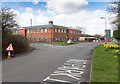
New housing at Orchard Court
View along Walton Road.
Work has started on the new housing development. Most of the trees and vegetation within and around the edge of the site have been cut down, and the foundations of the new houses are in already.
Image: © David P Howard
Taken: 5 Apr 2016
0.05 miles
9

New housing at Orchard Court
View from Walton Road.
Work has started on the new housing development. Most of the trees and vegetation within and around the edge of the site have been cut down, and the foundations of the new houses are in already.
Image: © David P Howard
Taken: 5 Apr 2016
0.05 miles
10

Access roads are laid out
Looking south west from Walton Road across the northern part of the new housing development off the A429 south of Wellesbourne.
The access roads are being laid but the torrential rains of the last few weeks have made the whole site very waterlogged.
Image: © David P Howard
Taken: 6 Jan 2014
0.05 miles