
IMAGES TAKEN NEAR TO
Walton, WARWICK, CV35 9HL
Introduction
This page details the photographs taken nearby to CV35 9HL by members of the Geograph project.
The Geograph project started in 2005 with the aim of publishing, organising and preserving representative images for every square kilometre of Great Britain, Ireland and the Isle of Man.

There are currently over 7.5m images from over14,400 individuals and you can help contribute to the project by visiting https://www.geograph.org.uk
Image Map
Images are licensed for reuse under creativecommons.org/licenses/by-sa/2.0
Notes
- Clicking on the map will re-center to the selected point.
- The higher the marker number, the further away the image location is from the centre of the postcode.
Image Listing (12 Images Found)
Images are licensed for reuse under creativecommons.org/licenses/by-sa/2.0
Image
Details
Distance
2
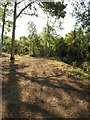
Bridleway in Roundhill Wood
Running close to the southern edge of the wood, and separated from that edge by a tiny tributary of the River Dene. The bridleway connects Walton Hall to the Fosse Way.
Image: © Derek Harper
Taken: 11 Jun 2011
0.10 miles
3
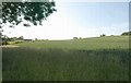
Wheat by Roundhill Wood
From the same spot as Image looking to the left beneath an ash tree, up towards the ridge that carries the Fosse Way. The buildings on the left are at Walton Wood Farm.
Image: © Derek Harper
Taken: 11 Jun 2011
0.11 miles
4
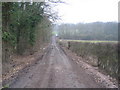
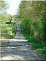
Footpath to Walton Hall
The footpath and farm track as it runs westwards close to the southern edge of the square from the Fosse Way towards Roundhill Wood.
Image: © David Stowell
Taken: 4 Feb 2006
0.13 miles
5
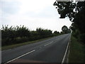
The Fosse Way, here the B4455
Heading SSW for Halford and Moreton-in-Marsh.
Image: © David Purchase
Taken: 11 Sep 2014
0.15 miles
7
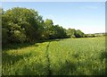
Edge of field, Roundhill Wood
Taken whilst trying to regain the bridleway - see Image The right of way emerges from the wood just left of the telegraph pole and crosses the field of barley.
Image: © Derek Harper
Taken: 11 Jun 2011
0.21 miles
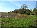
10
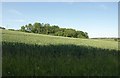
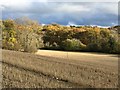
Eight Men's Math
The eastern edge of the curiously-named wood seen from the edge of Roundhill Wood, seen across a field of wheat.
Image: © Derek Harper
Taken: 11 Jun 2011
0.23 miles