
IMAGES TAKEN NEAR TO
Loxley Lane, WARWICK, CV35 9EN
Introduction
This page details the photographs taken nearby to Loxley Lane, CV35 9EN by members of the Geograph project.
The Geograph project started in 2005 with the aim of publishing, organising and preserving representative images for every square kilometre of Great Britain, Ireland and the Isle of Man.

There are currently over 7.5m images from over14,400 individuals and you can help contribute to the project by visiting https://www.geograph.org.uk
Image Map
Images are licensed for reuse under creativecommons.org/licenses/by-sa/2.0
Notes
- Clicking on the map will re-center to the selected point.
- The higher the marker number, the further away the image location is from the centre of the postcode.
Image Listing (17 Images Found)
Images are licensed for reuse under creativecommons.org/licenses/by-sa/2.0
Image
Details
Distance
1
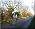
Entrance to Newlands Caravan Park
View North up the lane alongside the airfield, past the entrance to Newlands Caravan Park.
Image: © David P Howard
Taken: 17 Jan 2010
0.02 miles
2

Refuelling Stop?
The last airworthy Vulcan bomber in the UK, XH558, flies over Wellesbourne Airfield as one of the destinations on its 21st. June 2015 flight plan. http://www.vulcantothesky.org/appearances.html
Image: © David P Howard
Taken: 21 Jun 2015
0.07 miles
3

Fuel Storage
This is one of the tanks that stores aviation fuel and one of the tankers that supplies it to the individual aircraft. it is located in a corner of the field away from buildings.
Image: © Nigel Mykura
Taken: 24 Jul 2011
0.08 miles
4

Wellesbourne Airfield
Looking across the main runway towards the old hangar which now form part of an industrial estate.
Image: © David Stowell
Taken: 13 Dec 2005
0.10 miles
5

Footpath to Loxley from Newlands
The start of the footpath to Loxley where it leaves the lane alongside the airfield by Newlands Caravan Park.
Image: © David P Howard
Taken: 17 Jan 2010
0.10 miles
6

Mountford Airfield, Wellesbourne
Viewed from Loxley Lane. Wellesbourne Mountford Airfield, formerly the Royal Air Force station RAF Wellesbourne Mountford, was originally opened in 1941 for RAF Bomber Command. Following the closure of the RAF station, the airfield has been reduced in size and is now primarily a general aviation airfield. It has a CAA Ordinary Licence that allows flights for the public transport of passengers or for flying instruction http://ukga.com/airfield/wellesbourne-mountford .
Image: © David Dixon
Taken: 5 Jul 2013
0.13 miles
7

Wellesbourne Mountford Airfield
Viewed from Loxley Lane. Wellesbourne Mountford Airfield, formerly the Royal Air Force station RAF Wellesbourne Mountford, was originally opened in 1941 for RAF Bomber Command. Following the closure of the RAF station, the airfield has been reduced in size and is now primarily a general aviation airfield. It has a CAA Ordinary Licence that allows flights for the public transport of passengers or for flying instruction http://ukga.com/airfield/wellesbourne-mountford .
Image: © David Dixon
Taken: 5 Jul 2013
0.13 miles
8

Eastern end of Hunscote Lane
View East along Eastern end of Hunscote Lane.
Image: © David P Howard
Taken: 31 Dec 2009
0.16 miles
9

Wellesbourne Airfield
Part of the standing and refuelling area for light aircraft near Newlands.
Image: © David Stowell
Taken: 13 Dec 2005
0.16 miles
10

Vulcan Bomber at Wellesbourne Airfield
Image: © Steve Daniels
Taken: 8 Feb 2003
0.17 miles