
IMAGES TAKEN NEAR TO
Thelsford, WARWICK, CV35 9EL
Introduction
This page details the photographs taken nearby to Thelsford, CV35 9EL by members of the Geograph project.
The Geograph project started in 2005 with the aim of publishing, organising and preserving representative images for every square kilometre of Great Britain, Ireland and the Isle of Man.

There are currently over 7.5m images from over14,400 individuals and you can help contribute to the project by visiting https://www.geograph.org.uk
Image Map
Images are licensed for reuse under creativecommons.org/licenses/by-sa/2.0
Notes
- Clicking on the map will re-center to the selected point.
- The higher the marker number, the further away the image location is from the centre of the postcode.
Image Listing (12 Images Found)
Images are licensed for reuse under creativecommons.org/licenses/by-sa/2.0
Image
Details
Distance
1
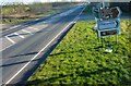
Junction on A429
Turning is part of one of the bus routes between Warwick and Stratford-upon-Avon
Image: © Clint Mann
Taken: 24 Feb 2016
0.03 miles
2

Thelsford Pumping Station
This Severn Trent Water pumping station is just off the A429 between Wasperton and Wellesbourne.
Image: © Nigel Mykura
Taken: 20 Dec 2009
0.03 miles
3

A429 road junction near Charlecote Park
A429 heading north; the road off to the left takes traffic to NT Charlecote Park and the nearby village of Hampton Lucy.
Image: © Mike Dodman
Taken: 15 Nov 2016
0.04 miles


6
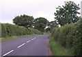
Road to Charlecote
The road from the A429 at Thelsford, taken near the spot where Image was taken. A steady downpour has just commenced, which helps to explain why it's so dark at least two hours before sunset. Time for some speed walking.
Image: © Derek Harper
Taken: 10 Jun 2011
0.11 miles
7

Stubble Field near Thelsford
This field of stubble is all that remains of one of the first field to be harvested in this area.
Image: © Nigel Mykura
Taken: 24 Jul 2011
0.12 miles
8
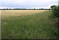
Field, Thelsford
Flat round here. The field is in the fork between the A429 and the road into Charlecote (from which the photo was taken), and south of the pumping station at Thelsford. Just detectable on the left are parts of Image It's so gloomy I can't tell what's growing in this field but I think it's barley.
Image: © Derek Harper
Taken: 10 Jun 2011
0.17 miles
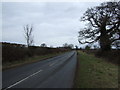
10

Welcome to the District of Stratford on Avon
Image: © Roy Hughes
Taken: 21 May 2024
0.20 miles