
IMAGES TAKEN NEAR TO
Hatton, WARWICK, CV35 8XD
Introduction
This page details the photographs taken nearby to CV35 8XD by members of the Geograph project.
The Geograph project started in 2005 with the aim of publishing, organising and preserving representative images for every square kilometre of Great Britain, Ireland and the Isle of Man.

There are currently over 7.5m images from over14,400 individuals and you can help contribute to the project by visiting https://www.geograph.org.uk
Image Map
Images are licensed for reuse under creativecommons.org/licenses/by-sa/2.0
Notes
- Clicking on the map will re-center to the selected point.
- The higher the marker number, the further away the image location is from the centre of the postcode.
Image Listing (31 Images Found)
Images are licensed for reuse under creativecommons.org/licenses/by-sa/2.0
Image
Details
Distance
1
Two houses, Curlieu Lane
Woodland by Nunhold Grange recedes in the background.
Image: © Robin Stott
Taken: 3 May 2010
0.05 miles
3
Curlieu Lane approaches M40
The junction is the turning for Hatton station and Pinley. The postbox ID is CV35 42. Curlieu Lane continues north for 2km to Hatton Green. The phone mast is one of a pair that is prominent by the M40, together with this bridge near the summit at Pinley, 5km northwest of Warwick.
Image: © Robin Stott
Taken: 3 May 2010
0.09 miles
4
Field by Curlieu Lane
Near the junction with Norton Curlieu Lane. A small woodland has been planted, beyond the oak, centre. To the left, among the trees, is the M40 in a cutting. From a summit near Pinley it runs 5km downhill to Junction 15 near Warwick. The noise of motorway traffic pervades this countryside.
Image: © Robin Stott
Taken: 3 May 2010
0.11 miles
5
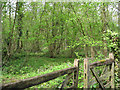
Coppice with standards, Curlieu Lane
Rather neglected, between 'St Austell' and Nunhold Grange.
Image: © Robin Stott
Taken: 3 May 2010
0.11 miles
6
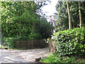
Entrance to Nunhold Grange
A big Victorian or Edwardian pile in orange brick.
Image: © Robin Stott
Taken: 5 May 2010
0.12 miles
7
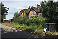
Semi-detached cottages near Nunhold Grange
The location is at the eastern end of the unnamed lane to Great Pinley and Pinley Green, in the corner formed with Dark Lane (behind the camera) and the M40 in a cutting at the back: out of shot left in Image
Image: © Robin Stott
Taken: 4 Aug 2018
0.13 miles
8
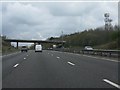
Telecommunication masts at Little Nunhold Farm
Image: © Peter Whatley
Taken: 3 Apr 2012
0.15 miles
10
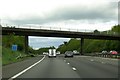
Bridge over the M40
The bridge carries a rural road from Norton Lindsey to Hatton.
Image: © Steve Daniels
Taken: 9 May 2015
0.16 miles