
IMAGES TAKEN NEAR TO
Hooknell, WARWICK, CV35 8QU
Introduction
This page details the photographs taken nearby to Hooknell, CV35 8QU by members of the Geograph project.
The Geograph project started in 2005 with the aim of publishing, organising and preserving representative images for every square kilometre of Great Britain, Ireland and the Isle of Man.

There are currently over 7.5m images from over14,400 individuals and you can help contribute to the project by visiting https://www.geograph.org.uk
Image Map
Images are licensed for reuse under creativecommons.org/licenses/by-sa/2.0
Notes
- Clicking on the map will re-center to the selected point.
- The higher the marker number, the further away the image location is from the centre of the postcode.
Image Listing (11 Images Found)
Images are licensed for reuse under creativecommons.org/licenses/by-sa/2.0
Image
Details
Distance
1

'Hooknell' from Ardenhill Spinney
The view is across the M40 corridor with the woodlands of Grove Park on the skyline, left Image Several groups of decaying straw bales provide a foreground at this viewpoint.
Image: © Robin Stott
Taken: 18 Jan 2011
0.06 miles
2

Track to Hooknell
This appears very rural however just beyond this house is the M40 motorway.
Image: © Philip Halling
Taken: 31 Oct 2022
0.08 miles
3
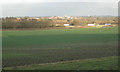
Shadow of Ardenhill Spinney across a field
Lorries pass back and forth on the M40 east of 'Hooknell'. The motorway is hidden by the trees, left, following the course of the Horse Brook Image Warwick, a hill town, sits in winter sunshine around the tower of St Mary's Church, top centre Image
Image: © Robin Stott
Taken: 18 Jan 2011
0.12 miles
4
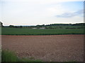
Near Longbridge
Looking across the square to New Barn Farm from the bridle way to Ardenhill Spinney.
Image: © David Stowell
Taken: 29 May 2005
0.17 miles

6

Bridleway past a plantation
The bridleway heads east from Ardenhill Spinney to meet the B4463 just beyond an unnamed plantation. The B4463 crosses the M40, left. Several groups of decaying straw bales provide a foreground at this viewpoint.
Image: © Robin Stott
Taken: 18 Jan 2011
0.20 miles
7
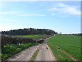
Ardenhill Spinney
The spinney is the block of woodland next to the track in the distance. The track runs from the B4463 at the M40 to Norton Lindsey. At this point it also marks the route of Shakespeare's Avon Way long distance footpath.
Image: © Nigel Mykura
Taken: 25 Mar 2012
0.21 miles


10
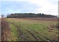
Ardenhill Spinney
Looking east up the bridleway that passes to the north of Ardenhill Spinney.
Image: © David P Howard
Taken: 3 Jan 2011
0.25 miles