
IMAGES TAKEN NEAR TO
Buttermilk Lane, WARWICK, CV35 8HP
Introduction
This page details the photographs taken nearby to Buttermilk Lane, CV35 8HP by members of the Geograph project.
The Geograph project started in 2005 with the aim of publishing, organising and preserving representative images for every square kilometre of Great Britain, Ireland and the Isle of Man.

There are currently over 7.5m images from over14,400 individuals and you can help contribute to the project by visiting https://www.geograph.org.uk
Image Map
Images are licensed for reuse under creativecommons.org/licenses/by-sa/2.0
Notes
- Clicking on the map will re-center to the selected point.
- The higher the marker number, the further away the image location is from the centre of the postcode.
Image Listing (12 Images Found)
Images are licensed for reuse under creativecommons.org/licenses/by-sa/2.0
Image
Details
Distance
1
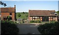
Valley Farm, Yarningale Common
There are modern farm buildings at the back.
Image: © Robin Stott
Taken: 1 May 2011
0.05 miles
2
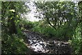
Muddy corner, Hobbs Hole Lane
The 1:25,000 map shows a spring close by. This would explain the total muddiness despite an exceptionally dry April. Elsewhere on Hobbs Hole Lane (an unclassified county road) the surface was dusty and hard.
Image: © Robin Stott
Taken: 1 May 2011
0.08 miles
3
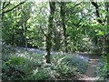
Bluebells in woodland, Yarningale Common
Image: © Robin Stott
Taken: 1 May 2011
0.09 miles
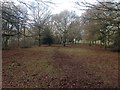
5
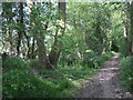
Hobbs Hole Lane
An unclassified county road between Yarningale Common and Holywell. The vegetation to each side is essentially a sliver of woodland rather than a hedgerow.
Image: © Robin Stott
Taken: 1 May 2011
0.15 miles
6
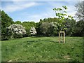
Mill Mound, Yarningale Common
The publicly accessible common is spread over a low hill and level ground to the south. The circular Mill Mound is at the summit and is visible on satellite photos. The 1887 OS map indicates rough grassland and no mill. In the early 20th century it was mostly treeless with some scrub. Photos from the 1940s show scrub woodland developing http://www.search.windowsonwarwickshire.org.uk/engine/resource/default.asp?txtKeywords=yarningale&lstContext=&lstResourceType=&lstExhibitionType=&chkPurchaseVisible=&txtDateFrom=&txtDateTo=&originator=%2Fengine%2Fsearch%2Fdefault%5Fhndlr%2Easp&page=&records=&direction=&pointer=27232&text=0&resource=8005
Image: © Robin Stott
Taken: 1 May 2011
0.19 miles
7
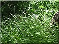
Wood Melick, Hobbs Hole Lane
Wood Melick (Melica uniflora) is a native perennial grass, "common in woods and shady places throughout Britain, though rare in the north of Scotland and Ireland." [Phillips. Grasses, Ferns, Mosses & Lichens. Pan, 1980]. "In some woods it is very abundant, and in May it will be found nodding gracefully beside the primroses and bluebells … The delicacy of its stems and flowers is particularly pleasing …" [The Observer's Book of British Grasses, Sedges & Rushes. No date].
Hobbs Hole Lane is an unclassified county road between Yarningale Common and Holywell.
Image: © Robin Stott
Taken: 1 May 2011
0.21 miles
8
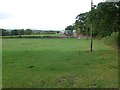
Fields next to Common Lane
These fields are just south of the lane which runs along the southern edge of Yarningale Common, north of Claverdon.
Image: © Nigel Mykura
Taken: 9 Oct 2011
0.22 miles
9
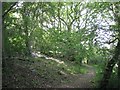
Woodland, north side of Mill Mound
Mill Mound is at the summit of the wooded knoll which is the northern part of Yarningale Common. There are bluebells in places.
Image: © Robin Stott
Taken: 1 May 2011
0.24 miles
10
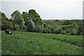
A seat on Mill Mound, Yarningale Common
The people on the bench are enjoying a view across to Preston Bagot SP1765 while the camera sees a skyline of fields and woodland northeast of Austy Wood, perhaps SP1763. The 1887 OS map shows the mound but without a mill.
Image: © Robin Stott
Taken: 1 May 2011
0.24 miles