
IMAGES TAKEN NEAR TO
Barford Bypass, CV35 8EG
Introduction
This page details the photographs taken nearby to Barford Bypass, CV35 8EG by members of the Geograph project.
The Geograph project started in 2005 with the aim of publishing, organising and preserving representative images for every square kilometre of Great Britain, Ireland and the Isle of Man.

There are currently over 7.5m images from over14,400 individuals and you can help contribute to the project by visiting https://www.geograph.org.uk
Image Map
Images are licensed for reuse under creativecommons.org/licenses/by-sa/2.0
Notes
- Clicking on the map will re-center to the selected point.
- The higher the marker number, the further away the image location is from the centre of the postcode.
Image Listing (43 Images Found)
Images are licensed for reuse under creativecommons.org/licenses/by-sa/2.0
Image
Details
Distance
2
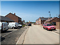
Nursery Meadows housing development
A new housing development by Taylor Wimpey off Wellesbourne Road.
Image: © David P Howard
Taken: 9 Jun 2016
0.05 miles
3
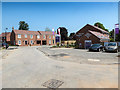
Nursery Meadows housing development
The sales information centre on the Taylor Wimpey development off Wellesbourne Road.
Image: © David P Howard
Taken: 9 Jun 2016
0.08 miles
4
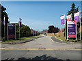
Entrance to Nursery Meadow
A new housing development by Taylor Wimpey off Wellesbourne Road.
Image: © David P Howard
Taken: 9 Jun 2016
0.08 miles
5
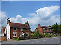
Houses on the Wellesbourne Rd Barford
These older style detached red brick houses are on the southern edge of the village close to Wasperton Lane
Image: © Nigel Mykura
Taken: 2 Jul 2011
0.09 miles
6
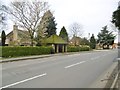
Barford, bus shelter
On Wellesbourne Road.
Image: © Mike Faherty
Taken: 19 Feb 2017
0.10 miles
7
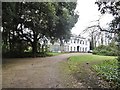
Barford House
Regency house on Wellesbourne Road, with literary connections; listed by Historic England (Grade II*): http://www.imagesofengland.org.uk/Details/Default.aspx?id=307940&mode=adv
Image: © Mike Faherty
Taken: 19 Feb 2017
0.11 miles
8
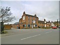
Barford, Granville
Pub and restaurant on Wellesbourne Road; formerly Granville Arms. The building is early C19, and listed by Historic England: http://www.imagesofengland.org.uk/Details/Default.aspx?id=307938&mode=adv
Image: © Mike Faherty
Taken: 19 Feb 2017
0.11 miles
9
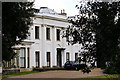
Still time to save?
This fine villa is Barford House which has apparently been undergoing slow renovation for many years. Although it looks in reasonable condition in this photo parts of the building appear semi-derelict. It dates from at least the Regency period and has been home to a Rear Admiral, a local MP, a school attended by Victorian novelist Mrs Gaskell and latterly was owned by Rolls Royce before reverting to private hands.
Image: © Colin Craig
Taken: 10 Mar 2009
0.11 miles
10
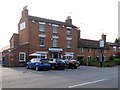
Barford, The Granville
Pub/restaurant on Wellesbourne Road.
Image: © David Dixon
Taken: 5 Jul 2013
0.11 miles