
IMAGES TAKEN NEAR TO
Wasperton Lane, WARWICK, CV35 8DH
Introduction
This page details the photographs taken nearby to Wasperton Lane, CV35 8DH by members of the Geograph project.
The Geograph project started in 2005 with the aim of publishing, organising and preserving representative images for every square kilometre of Great Britain, Ireland and the Isle of Man.

There are currently over 7.5m images from over14,400 individuals and you can help contribute to the project by visiting https://www.geograph.org.uk
Image Map
Images are licensed for reuse under creativecommons.org/licenses/by-sa/2.0
Notes
- Clicking on the map will re-center to the selected point.
- The higher the marker number, the further away the image location is from the centre of the postcode.
Image Listing (7 Images Found)
Images are licensed for reuse under creativecommons.org/licenses/by-sa/2.0
Image
Details
Distance
1

View west from Hareway Lane near Lower Watchbury Farm
Image: © David P Howard
Taken: 22 May 2010
0.12 miles
2

Footpath to Barford Church
The footpath (on the right of the picture) runs along the side of this field in the North West corner of the square.
Image: © David Stowell
Taken: 28 May 2005
0.21 miles
3

Stile on footpath to Barford
The Northern boundary to the square seems to run diagonally across this stile!
Image: © David Stowell
Taken: 28 May 2005
0.21 miles
4

Pond by Hareway Lane
This pond is just by the footpath to Barford from Hareway Lane.
Image: © David P Howard
Taken: 22 May 2010
0.21 miles
5

The ruin
A ruined barn taken from a country footpath in Barford. The looming trees seemed to make it even more threatening.
Image: © Colin Craig
Taken: 31 Mar 2009
0.21 miles
6

Hareway Lane
A narrow country lane wending its way from Barford.
Image: © Colin Craig
Taken: 31 Mar 2009
0.24 miles
7
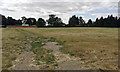
Grounds of Watchbury Hill across a field
The house appears to occupy extensive woodland on the summit of the hill. The view is from Hareway Lane.
Image: © Robin Stott
Taken: 1 Aug 2018
0.25 miles