
IMAGES TAKEN NEAR TO
Ryland Road, WARWICK, CV35 8BY
Introduction
This page details the photographs taken nearby to Ryland Road, CV35 8BY by members of the Geograph project.
The Geograph project started in 2005 with the aim of publishing, organising and preserving representative images for every square kilometre of Great Britain, Ireland and the Isle of Man.

There are currently over 7.5m images from over14,400 individuals and you can help contribute to the project by visiting https://www.geograph.org.uk
Image Map
Images are licensed for reuse under creativecommons.org/licenses/by-sa/2.0
Notes
- Clicking on the map will re-center to the selected point.
- The higher the marker number, the further away the image location is from the centre of the postcode.
Image Listing (16 Images Found)
Images are licensed for reuse under creativecommons.org/licenses/by-sa/2.0
Image
Details
Distance
1

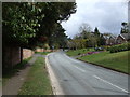
Modern housing in Barford
These houses were built in the grounds of the former Barford Hill House, demolished in the 1950s. The Windows on Warwickshire website has views of what the former mansion looked like (it was located further up Barford Hill and the site is now occupied by large executive-style homes).
Image: © Colin Craig
Taken: 10 Mar 2009
0.03 miles


7

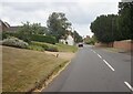
Country house
One of the large houses in this part of Barford, taken from a country path. The animals in the field appear to be alpacas.
Image: © Colin Craig
Taken: 31 Mar 2009
0.12 miles
8
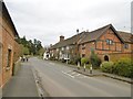
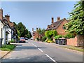
Barford, cottages
A pleasant line of cottages on High Street; two are listed by Historic England: http://www.imagesofengland.org.uk/Details/Default.aspx?id=307929&mode=adv
Image: © Mike Faherty
Taken: 19 Feb 2017
0.12 miles
9

Survivor
This is one of the service buildings of the former Barford Hill House, demolished in the 1950s. It was possibly the stables and is now converted to houses. It lies opposite what was the main entrance to the former mansion, which now has upmarket detached houses covering its site.
Image: © Colin Craig
Taken: 10 Mar 2009
0.12 miles
10

Stables and Clock Tower Barford Hill
This area of Barford is now dominated by large individual properties that stretch from the road down to the River Avon but this was once the only substantial property around.
An old image of it (1953) can be seen here:-
http://www.search.windowsonwarwickshire.org.uk/engine/resource/default.asp?theme=694&originator=%2Fengine%2Ftheme%2Fdefault%2Easp&page=&records=&direction=&pointer=1864&text=0&resource=452
Image: © Nigel Mykura
Taken: 2 Jul 2011
0.12 miles