IMAGES TAKEN NEAR TO
Sherbourne Hill, Stratford Road, WARWICK, CV35 8AG
Introduction
This page details the photographs taken nearby to Sherbourne Hill, Stratford Road, CV35 8AG by members of the Geograph project.
The Geograph project started in 2005 with the aim of publishing, organising and preserving representative images for every square kilometre of Great Britain, Ireland and the Isle of Man.

There are currently over 7.5m images from over14,400 individuals and you can help contribute to the project by visiting https://www.geograph.org.uk
Image Map
Images are licensed for reuse under creativecommons.org/licenses/by-sa/2.0
Notes
- Clicking on the map will re-center to the selected point.
- The higher the marker number, the further away the image location is from the centre of the postcode.
Image Listing (12 Images Found)
Images are licensed for reuse under creativecommons.org/licenses/by-sa/2.0
Image
Details
Distance
1

Nineteenth-century benchmark on Hillcrest
This bench mark was established between 1850 and 1856 during the First primary levelling of England & Wales, and was levelled with a height of 285.5160 feet [87.0253 metres] above mean sea level (Liverpool datum). It was included on the Basingstoke to Coventry levelling line. The surveyor's description was "No. 195. Mark on front of house at South side of road, Sherbourn Hill ; 1.65 ft. above surface" (Public Abstract p.240).
Image: © Shantavira
Taken: 23 Jun 2015
0.01 miles
2

Hillcrest Bed and Breakfast.
This B&B is next to the main A46. The road has been turned into a dual carriageway but the old road has been left as a lay-by in which the house stands.
Image: © Nigel Mykura
Taken: 25 Mar 2012
0.01 miles
3

Sherbourne Hill
Hillcrest B&B beside the busy A46
Image: © David Stowell
Taken: 29 May 2005
0.03 miles
4

Sherbourne Hill
The A46 with a distant view of Warwick highlighted by the evening sun.
Image: © David Stowell
Taken: 29 May 2005
0.03 miles
5

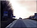
A46 by Coplow Wood
Sign for Stratford on Avon district on left verge
Image: © John Firth
Taken: 26 Sep 2012
0.04 miles
6

The old route of the A46, Sherbourne Hill
This was the old route of the A46 as it climbed Sherbourne Hill, as evidenced by the still visible double white lines. The new dual carriageway is on the left.
Image: © David P Howard
Taken: 21 Sep 2010
0.05 miles
7

Footpath crosses the A46, Sherbourne Hill
The Shakespeare's Avon Way footpath crosses the A46 dual carriageway at this point, although getting over four lanes of speeding traffic in one piece could be a problem.
Image: © David P Howard
Taken: 21 Sep 2010
0.06 miles