
IMAGES TAKEN NEAR TO
Pebworth Drive, WARWICK, CV35 7UD
Introduction
This page details the photographs taken nearby to Pebworth Drive, CV35 7UD by members of the Geograph project.
The Geograph project started in 2005 with the aim of publishing, organising and preserving representative images for every square kilometre of Great Britain, Ireland and the Isle of Man.

There are currently over 7.5m images from over14,400 individuals and you can help contribute to the project by visiting https://www.geograph.org.uk
Image Map
Images are licensed for reuse under creativecommons.org/licenses/by-sa/2.0
Notes
- Clicking on the map will re-center to the selected point.
- The higher the marker number, the further away the image location is from the centre of the postcode.
Image Listing (36 Images Found)
Images are licensed for reuse under creativecommons.org/licenses/by-sa/2.0
Image
Details
Distance
1
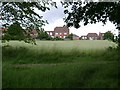
The north end of Hatton Park
Hatton Park is an extensive residential redevelopment of the county's central mental hospital and its grounds, which include two cemeteries and some fine trees. The inmates of the hospital were decanted into 'the community' and a secure mental hospital, St Michael's, in Warwick.
Image: © Robin Stott
Taken: 13 Jul 2009
0.02 miles
3
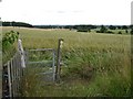
Gate at a junction of footpaths
Near Turkey Farm, fields of wheat and annual ryegrass slope down to the northern edge of Hatton Park. The tower of St Mary's Church, Warwick, appears on the skyline, right.
Image: © Robin Stott
Taken: 13 Jul 2009
0.08 miles
4
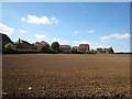
Tidy fields and tidy housing
Looking west across the recently ploughed fields on the edge of the housing development in the grounds of the former Hatton Sanatorium.
Image: © David Stowell
Taken: 9 Sep 2007
0.10 miles
5
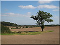
View towards Warwick
Looking east from the footpath on the edge of the modern Hatton housing estate with the buildings of Warwick and Leamington Spa visible in the distance.
Image: © David Stowell
Taken: 9 Sep 2007
0.10 miles
7
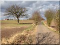
Bridleway to Rouncil Lane near Turkey Farm
Looking north up the bridleway which runs from Barcheston Drive, Hatton Park, to Rouncil Lane, Kenilworth.
Turkey Farm is on the left in the distance.
Image: © David P Howard
Taken: 14 Mar 2013
0.12 miles
8
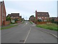
Barcheston Drive, Hatton Park
View NW up Barcheston Drive from the bus stop opposite Dorsington Crescent.
Image: © David P Howard
Taken: 8 Sep 2010
0.12 miles
10

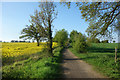
Turkey Farm
No turkeys seen or heard, only builders.
Image: © Robin Stott
Taken: 13 Jul 2009
0.13 miles