
IMAGES TAKEN NEAR TO
Mickleton Drive, WARWICK, CV35 7TA
Introduction
This page details the photographs taken nearby to Mickleton Drive, CV35 7TA by members of the Geograph project.
The Geograph project started in 2005 with the aim of publishing, organising and preserving representative images for every square kilometre of Great Britain, Ireland and the Isle of Man.

There are currently over 7.5m images from over14,400 individuals and you can help contribute to the project by visiting https://www.geograph.org.uk
Image Map
Images are licensed for reuse under creativecommons.org/licenses/by-sa/2.0
Notes
- Clicking on the map will re-center to the selected point.
- The higher the marker number, the further away the image location is from the centre of the postcode.
Image Listing (113 Images Found)
Images are licensed for reuse under creativecommons.org/licenses/by-sa/2.0
Image
Details
Distance
1
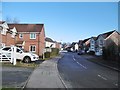
Hatton Park, Admington Drive
Suburban road and housing, on the site of a former hospital: http://www.hattonpark.net/history
Image: © Mike Faherty
Taken: 18 Nov 2016
0.02 miles
2
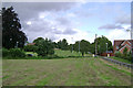
Open spaces, Hatton Park
The residential redevelopment of the mental hospital site retained the grounds as public open space. In the foreground is one of the cemeteries with a field beyond that was for cricket and rounders.
Image: © Robin Stott
Taken: 13 Jul 2009
0.05 miles
3

Former inmate cemetery, Central Hospital, Hatton
This area of greenery has been left undisturbed by housing development of the former Central Hospital site in Hatton, Warwickshire. The hospital was a former mental home and a plaque on the site says this area was the former cemetery for inmates between 1891-1966.
Image: © Colin Craig
Taken: 4 Apr 2010
0.05 miles
4
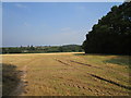
Stubble field and Hatton Park
Hatton Park is the area of housing built on the site of the former County Mental Hospital.
Image: © Jonathan Thacker
Taken: 16 Sep 2020
0.06 miles
5
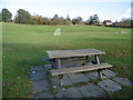
Hatton Park, open space
In the grounds of the former Central Hospital: http://www.hattonpark.net/history
Image: © Mike Faherty
Taken: 18 Nov 2016
0.09 miles
6
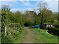
Track and footpath to the A4177 in Hatton
Image: © Mat Fascione
Taken: 4 May 2015
0.09 miles
7

Open spaces, Hatton Park
The residential redevelopment of the county's central mental hospital retained the grounds as public open space, including two cemeteries for inmates that died. This is the larger cemetery, on the southern edge of the site. The ground beyond it may have been an orchard.
Image: © Robin Stott
Taken: 13 Jul 2009
0.10 miles
8
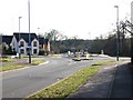
Roundabout at junction of Charingworth Drive and Ebrington Drive
View South down Charingworth Drive.
Image: © David P Howard
Taken: 11 Feb 2010
0.10 miles
9
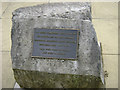
Memorial plaque, Hatton Park
Hatton Park is residential redevelopment of the county's central mental hospital and its grounds. There were two cemeteries for inmates that died, preserved now as public open spaces.
Image: © Robin Stott
Taken: 13 Jul 2009
0.10 miles
10
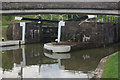
Lock 36, Grand Union Canal
Lock 36 is exactly half way up (or down) the Hatton Flight.
Image: © Stephen McKay
Taken: 8 Aug 2010
0.12 miles