IMAGES TAKEN NEAR TO
The Elms, WARWICK, CV35 7RR
Introduction
This page details the photographs taken nearby to The Elms, CV35 7RR by members of the Geograph project.
The Geograph project started in 2005 with the aim of publishing, organising and preserving representative images for every square kilometre of Great Britain, Ireland and the Isle of Man.

There are currently over 7.5m images from over14,400 individuals and you can help contribute to the project by visiting https://www.geograph.org.uk
Image Map
Images are licensed for reuse under creativecommons.org/licenses/by-sa/2.0
Notes
- Clicking on the map will re-center to the selected point.
- The higher the marker number, the further away the image location is from the centre of the postcode.
Image Listing (79 Images Found)
Images are licensed for reuse under creativecommons.org/licenses/by-sa/2.0
Image
Details
Distance
1

Houses in The Elms
(opposite the church)
Image: © Basher Eyre
Taken: 11 Feb 2019
0.03 miles
3
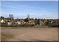
Carpark, All Saints Church, Leek Wootton
Looking east over the car park, across the houses on Warwick Road.
Image: © David P Howard
Taken: 16 Mar 2010
0.07 miles
4
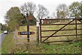
Field east of the parish church, Leek Wootton
Image: © Robin Stott
Taken: 6 Nov 2009
0.09 miles
5
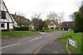
Entrance to The Elms. Leek Wootton
The furthest houses are Image
Image: © Robin Stott
Taken: 6 Nov 2009
0.09 miles
6
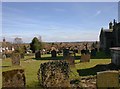
View from the churchyard, All Saints, Leek Wootton
Looking east across the churchyard.
Image: © David P Howard
Taken: 16 Mar 2010
0.09 miles
7
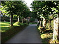
Tree-lined driveway, Leek Wootton church
This is the driveway to the church car park. The mini 'give way' sign which is just visible is a warning to exiting traffic to be aware there may be other vehicles on the minor lane just beyond.
For a contrast in seasons, see Image] for the same view in March.
According to a Warwickshire County Council leaflet, 'the lime trees that line the paths were donated and planted in 1844 by local people, including seven by various members of the Wise family' (who lived at the nearby 'big house', Woodcote)
Image: © John Brightley
Taken: 5 Aug 2010
0.09 miles
9
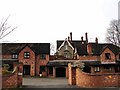
Masked by mews
This modern mews development blocks the view of a fine Victorian villa from the main street of Leek Wootton. The development seems to have been created by cutting into what was an elevated lawn, according to historic photos on the Windows on Warwickshire website. You can see part of the villa between the two main blocks.
Image: © Colin Craig
Taken: 1 Feb 2009
0.10 miles