
IMAGES TAKEN NEAR TO
Kites Nest Lane, WARWICK, CV35 7PB
Introduction
This page details the photographs taken nearby to Kites Nest Lane, CV35 7PB by members of the Geograph project.
The Geograph project started in 2005 with the aim of publishing, organising and preserving representative images for every square kilometre of Great Britain, Ireland and the Isle of Man.

There are currently over 7.5m images from over14,400 individuals and you can help contribute to the project by visiting https://www.geograph.org.uk
Image Map
Images are licensed for reuse under creativecommons.org/licenses/by-sa/2.0
Notes
- Clicking on the map will re-center to the selected point.
- The higher the marker number, the further away the image location is from the centre of the postcode.
Image Listing (16 Images Found)
Images are licensed for reuse under creativecommons.org/licenses/by-sa/2.0
Image
Details
Distance
1
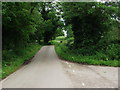
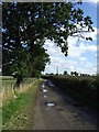
Looking north along Kites Nest Lane from the entrance to Bulloak Farm
Compare this very green summer view with Robin Stott's photo Image] from a similar viewpoint but taken in March without leaves on the trees.
Image: © John Brightley
Taken: 4 Jun 2012
0.04 miles
2
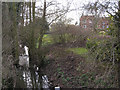
Inchford Brook by Inchford Brook Farm
Seen from Kite's Nest Lane, the brook is flowing towards the camera, on its long journey to Kenilworth and beyond.
Image: © Robin Stott
Taken: 21 Mar 2010
0.05 miles
3
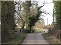
Kite's Nest Lane crosses Inchford Brook
A gridline runs through it. The leafy summer scene is pictured in Image
Image: © Robin Stott
Taken: 21 Mar 2010
0.05 miles
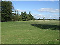
5
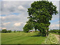
Bulloak Farm
View across the fields, with the farm buildings framed in amongst the trees.
Image: © David Stowell
Taken: 31 May 2005
0.06 miles
7
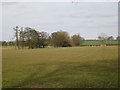
Inchford Brook near Bulloak Farm
The trees, left and centre, follow the brook as it heads northeast to Kenilworth. Bulloak Farm is behind the trees, left of centre.
Image: © Robin Stott
Taken: 21 Mar 2010
0.10 miles
8
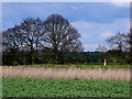
Pipe Line Marker
The fluorescent post in the hedgerow next to a field of beans marks where a gas pipe line passes underground at that point.
Image: © Nigel Mykura
Taken: 15 Apr 2012
0.13 miles
9
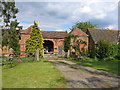
Kite's Nest Farm
The entrance to the farmyard with an imposing gateway and unconverted barns!
Image: © David Stowell
Taken: 31 May 2005
0.14 miles
10
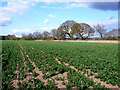
Field at Kite's Nest Farm
This grid square is fairly empty with no roads or buildings except on the very edges. This bean field which is showing patchy growth due to the dry spring is in the south western corner of the square close to the farm which is actually in SP2469.
Image: © Nigel Mykura
Taken: 15 Apr 2012
0.16 miles