
IMAGES TAKEN NEAR TO
Starmer Place, WARWICK, CV35 7LB
Introduction
This page details the photographs taken nearby to Starmer Place, CV35 7LB by members of the Geograph project.
The Geograph project started in 2005 with the aim of publishing, organising and preserving representative images for every square kilometre of Great Britain, Ireland and the Isle of Man.

There are currently over 7.5m images from over14,400 individuals and you can help contribute to the project by visiting https://www.geograph.org.uk
Image Map
Images are licensed for reuse under creativecommons.org/licenses/by-sa/2.0
Notes
- Clicking on the map will re-center to the selected point.
- The higher the marker number, the further away the image location is from the centre of the postcode.
Image Listing (27 Images Found)
Images are licensed for reuse under creativecommons.org/licenses/by-sa/2.0
Image
Details
Distance
1
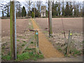
The path to Hatton Church
It leads from Hatton Green. Part of a long avenue of lime trees can be seen. It runs parallel to the Birmingham Road A4177 just beyond the church. The path is surfaced with crushed Hornton stone, an iron-tinged limestone quarried near Edge Hill on the Warwickshire-Oxfordshire border.
Image: © Robin Stott
Taken: 15 Mar 2010
0.03 miles
3
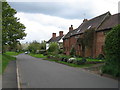
Hatton Green
A view through the village
Image: © David Stowell
Taken: 28 Apr 2005
0.10 miles
5
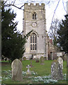
Holy Trinity Church, Hatton
The Perpendicular tower is described as being of white-stone, like Haseley church nearby Image
Image: © Robin Stott
Taken: 15 Mar 2010
0.10 miles
6
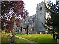
Hatton Church-Holy Trinity
On Birmingham Road.
Image: © Ian Rob
Taken: 26 Sep 2015
0.10 miles
9

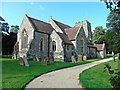
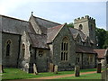
Holy Trinity, Hatton: gravestones near the chancel door
Image: © Basher Eyre
Taken: 8 Feb 2019
0.11 miles
10
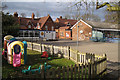
The Ferncumbe C of E Primary School playground
Image: © Robin Stott
Taken: 15 Mar 2010
0.12 miles