
IMAGES TAKEN NEAR TO
Birmingham Road, WARWICK, CV35 7JP
Introduction
This page details the photographs taken nearby to Birmingham Road, CV35 7JP by members of the Geograph project.
The Geograph project started in 2005 with the aim of publishing, organising and preserving representative images for every square kilometre of Great Britain, Ireland and the Isle of Man.

There are currently over 7.5m images from over14,400 individuals and you can help contribute to the project by visiting https://www.geograph.org.uk
Image Map
Images are licensed for reuse under creativecommons.org/licenses/by-sa/2.0
Notes
- Clicking on the map will re-center to the selected point.
- The higher the marker number, the further away the image location is from the centre of the postcode.
Image Listing (129 Images Found)
Images are licensed for reuse under creativecommons.org/licenses/by-sa/2.0
Image
Details
Distance
1
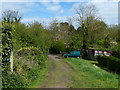
Track and footpath to the A4177 in Hatton
Image: © Mat Fascione
Taken: 4 May 2015
0.02 miles
2

Open spaces, Hatton Park
The residential redevelopment of the county's central mental hospital retained the grounds as public open space, including two cemeteries for inmates that died. This is the larger cemetery, on the southern edge of the site. The ground beyond it may have been an orchard.
Image: © Robin Stott
Taken: 13 Jul 2009
0.02 miles

4
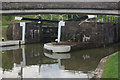
Lock 36, Grand Union Canal
Lock 36 is exactly half way up (or down) the Hatton Flight.
Image: © Stephen McKay
Taken: 8 Aug 2010
0.04 miles
5
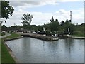
Grand Union Canal - Lock No. 36
This marks the mid-point of the twenty one lock Hatton Flight.
Image: © John M
Taken: 23 Aug 2008
0.05 miles
6

A4177 Birmingham Road near Hatton Park
The nearer houses and those in Hatton Close, left, are within the square and were probably built for staff of the former mental hospital, redeveloped for housing in the last twenty years
Image: © Robin Stott
Taken: 13 Jul 2009
0.05 miles
7

Rear of Hatton Terrace, Birmingham Road near Warwick
As Middle Lock Lane ascends to cross the Grand Union Canal, there is a view back to the rear of Hatton Terrace.
Image: © Robin Stott
Taken: 13 Jul 2009
0.05 miles
8
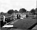
Hatton Locks, Grand Union Canal
With the passing years, Hatton Locks do not get any easier...
Image: © Dr Neil Clifton
Taken: 27 Aug 1981
0.05 miles
9
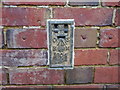
Ordnance Survey flush bracket 604
Ordnance Survey flush bracket no.604, on wall of 3 Middle Lock Lane. This flush bracket was used during the Second geodetic levelling of England & Wales, and was levelled with a height of 261.7700 feet [79.7875 metres] above mean sea level (Newlyn datum). It was included on the Bromsgrove to Warwick levelling line. The surveyor's description was Flush Bracket on W. face of cottage, N.E. side of canal, about 3½ chains S. from Canal Cottages.
Image: © Shantavira
Taken: 5 Jan 2013
0.05 miles
10
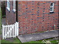
Ordnance Survey flush bracket 604
Ordnance Survey flush bracket no.604. Location shot for http://www.geograph.org.uk/photo/3285425
Image: © Shantavira
Taken: 5 Jan 2013
0.05 miles