IMAGES TAKEN NEAR TO
Hatton, WARWICK, CV35 7JH
Introduction
This page details the photographs taken nearby to CV35 7JH by members of the Geograph project.
The Geograph project started in 2005 with the aim of publishing, organising and preserving representative images for every square kilometre of Great Britain, Ireland and the Isle of Man.

There are currently over 7.5m images from over14,400 individuals and you can help contribute to the project by visiting https://www.geograph.org.uk
Image Map
Images are licensed for reuse under creativecommons.org/licenses/by-sa/2.0
Notes
- Clicking on the map will re-center to the selected point.
- The higher the marker number, the further away the image location is from the centre of the postcode.
Image Listing (2 Images Found)
Images are licensed for reuse under creativecommons.org/licenses/by-sa/2.0
Image
Details
Distance
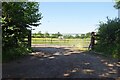
2
Haywood Lane
Looking NNW up Haywood Lane in the direction of Mousley End.
The ditch on the right hand side has been extensively cleaned out, and the spoil deposited on top of the grass verge.
Image: © David P Howard
Taken: 3 Apr 2013
0.18 miles