
IMAGES TAKEN NEAR TO
Lower Farm, Brownley Green Lane, WARWICK, CV35 7ER
Introduction
This page details the photographs taken nearby to Lower Farm, Brownley Green Lane, CV35 7ER by members of the Geograph project.
The Geograph project started in 2005 with the aim of publishing, organising and preserving representative images for every square kilometre of Great Britain, Ireland and the Isle of Man.

There are currently over 7.5m images from over14,400 individuals and you can help contribute to the project by visiting https://www.geograph.org.uk
Image Map
Images are licensed for reuse under creativecommons.org/licenses/by-sa/2.0
Notes
- Clicking on the map will re-center to the selected point.
- The higher the marker number, the further away the image location is from the centre of the postcode.
Image Listing (33 Images Found)
Images are licensed for reuse under creativecommons.org/licenses/by-sa/2.0
Image
Details
Distance
1
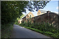
Lower Farm
Converted vernacular farm buildings at Lower Farm
Image: © P Gaskell
Taken: Unknown
0.02 miles
3
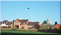
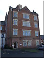
Housing on Barcheston Drive, Hatton
Part of an area of new housing centred around a large former hospital site. There is a mixture of new build and conversions of old hospital buildings.
Image: © Des Blenkinsopp
Taken: 5 May 2018
0.09 miles
4
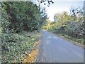
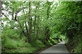
Hatton, lane
Brownlea Green Lane, from Birmingham Road to Beausale.
Image: © Mike Faherty
Taken: 18 Nov 2016
0.10 miles
5
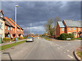
Junction of Barcheston Drive and Crimscote Square
Residential roads on the Hatton Park estate. http://www.hattonpark.net/
Image: © David P Howard
Taken: 14 Mar 2013
0.11 miles
8
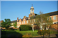
Hospital Conversion, Hatton Park
Afternoon sunshine on the buildings of a former hospital now converted into residential use.
Image: © Des Blenkinsopp
Taken: 5 May 2018
0.14 miles
9
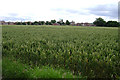
Hatton Park from west of Turkey Farm
Hatton Park is the residential redevelopment of the county's central mental hospital and its grounds. Inmates were decanted into 'the community' and a secure mental hospital, St Michael's, in Warwick.
Image: © Robin Stott
Taken: 13 Jul 2009
0.14 miles
10
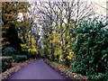
Beausale Lane
This heavily wooded lane runs down the hill from Brownley Green to Hatton.
Image: © Nigel Mykura
Taken: 21 Nov 2010
0.14 miles