IMAGES TAKEN NEAR TO
Holywell, WARWICK, CV35 7BJ
Introduction
This page details the photographs taken nearby to Holywell, CV35 7BJ by members of the Geograph project.
The Geograph project started in 2005 with the aim of publishing, organising and preserving representative images for every square kilometre of Great Britain, Ireland and the Isle of Man.

There are currently over 7.5m images from over14,400 individuals and you can help contribute to the project by visiting https://www.geograph.org.uk
Image Map
Images are licensed for reuse under creativecommons.org/licenses/by-sa/2.0
Notes
- Clicking on the map will re-center to the selected point.
- The higher the marker number, the further away the image location is from the centre of the postcode.
Image Listing (11 Images Found)
Images are licensed for reuse under creativecommons.org/licenses/by-sa/2.0
Image
Details
Distance
1
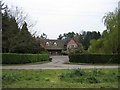
Holywell
A typical Warwickshire timber framed building seen across the village green.
Image: © David Stowell
Taken: 22 Apr 2005
0.07 miles
2
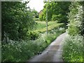
Lane west of Holywell Cottage Farm
The camera-shy birds look like guineafowl.
Image: © Robin Stott
Taken: 1 May 2011
0.07 miles
3
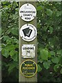
Waymarker, Holywell
The unclassified county road is Hobbs Hole Lane, which goes to Yarningale Common. This type of highway is (guessing) equivalent to a restricted byway in other counties.
Image: © Robin Stott
Taken: 1 May 2011
0.15 miles
4
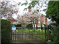
Holywell House
A lovely display of blossom, seen from the lane as it enters the small village of Holywell.
Image: © David Stowell
Taken: 22 Apr 2005
0.17 miles
5
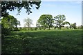
Bridleway through pasture near Holywell
Buildings at High Cross can be seen between the hedgerow oaks.
Image: © Robin Stott
Taken: 1 May 2011
0.20 miles
6
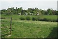
Pastures at Holywell
The building is called The Field House, on the west side of the loose cluster of farms and houses that is Holywell. Dandelion stalks give the light colour in the foreground.
Image: © Robin Stott
Taken: 1 May 2011
0.20 miles
7
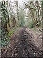
Country path
A country path and bridleway linking Holywell and Yarningdale Common near Claverdon. In medieval times every road was like this - time seems to have stood still here.
Image: © Colin Craig
Taken: 28 Mar 2009
0.20 miles
8
An irregular field
Footpaths between High Cross, Lowsonford, Pinley Green and Holywell cross in this field.
Image: © Robin Stott
Taken: 3 May 2011
0.21 miles
9
A short sharp slope
A characteristic knoll or short bluff under grass.
Image: © Robin Stott
Taken: 3 May 2011
0.21 miles