
IMAGES TAKEN NEAR TO
Shrewley Common, WARWICK, CV35 7AY
Introduction
This page details the photographs taken nearby to Shrewley Common, CV35 7AY by members of the Geograph project.
The Geograph project started in 2005 with the aim of publishing, organising and preserving representative images for every square kilometre of Great Britain, Ireland and the Isle of Man.

There are currently over 7.5m images from over14,400 individuals and you can help contribute to the project by visiting https://www.geograph.org.uk
Image Map
Images are licensed for reuse under creativecommons.org/licenses/by-sa/2.0
Notes
- Clicking on the map will re-center to the selected point.
- The higher the marker number, the further away the image location is from the centre of the postcode.
Image Listing (68 Images Found)
Images are licensed for reuse under creativecommons.org/licenses/by-sa/2.0
Image
Details
Distance
1
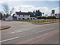
Durham Ox, Shrewley
A pub/restaurant on the edge of the village. https://www.oldenglishinns.co.uk/our-locations/durham-ox
Image: © David P Howard
Taken: 3 Apr 2013
0.02 miles
2
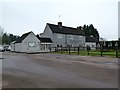
Shrewley-The Durham Ox
Public House on Shrewley Common.
Image: © Ian Rob
Taken: 18 Feb 2017
0.02 miles
4
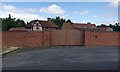
A very private property southwest of Shrewley
Historic England knows the timber-framed building as The Gatehouse, formerly the farmhouse of Shrewley Gate Farm. It is listed grade II https://historicengland.org.uk/listing/the-list/list-entry/1184612 The extensive property lies between the M40 and the railway.
Image: © Robin Stott
Taken: 2 Aug 2018
0.05 miles
5
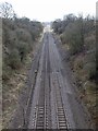
Railway at Shrewley
Looking south east from the railway bridge on Shrewley Common.
Image: © David P Howard
Taken: 3 Apr 2013
0.06 miles
6
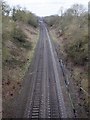
Railway at Shrewley
Looking north west from the railway bridge on Shrewley Common.
Image: © David P Howard
Taken: 3 Apr 2013
0.07 miles
7
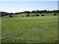
Shrewley Bridge Farm
The farm buildings are on the facing hillside south of Shrewley. The ground nearest the camera, part of a turf nursery, was a natural hillside whose profile was augmented with soil. At the time I assumed that the soil was left over from the construction of the M40, left. Now I wonder if it was the preparation for the nursery, because the regular lifting of the turf must remove soil from the site. From the motorway this ground does look a little bloated, a little mechanical, an impression reinforced by the dead-straight brook in the valley.
Image: © Robin Stott
Taken: 16 Jun 2010
0.11 miles
10
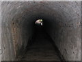
Shrewley Horse Tunnel (Grand Union Canal)
This horse tunnel leads down from the village of Shrewley to the Grand Union Canal, meeting the northern mouth of the Shrewley tunnel. Horses could not pass through the canal tunnel, they had to walk over the hill. This short tunnel provides the shortest (and possibly only?) route back to the canal tunnel mouth. One imagines that a longer route for the horses was considered and ruled out - or maybe there was a longer route for horses that refused the steep, dark and slippery descent/ascent through this tunnel. There is another image for this grid square which shows a view of the exit from this tunnel onto the towpath.
Image: © Simon Challinor
Taken: 1 Aug 2006
0.12 miles