
IMAGES TAKEN NEAR TO
St. Laurence Close, WARWICK, CV35 7AG
Introduction
This page details the photographs taken nearby to St. Laurence Close, CV35 7AG by members of the Geograph project.
The Geograph project started in 2005 with the aim of publishing, organising and preserving representative images for every square kilometre of Great Britain, Ireland and the Isle of Man.

There are currently over 7.5m images from over14,400 individuals and you can help contribute to the project by visiting https://www.geograph.org.uk
Image Map
Images are licensed for reuse under creativecommons.org/licenses/by-sa/2.0
Notes
- Clicking on the map will re-center to the selected point.
- The higher the marker number, the further away the image location is from the centre of the postcode.
Image Listing (66 Images Found)
Images are licensed for reuse under creativecommons.org/licenses/by-sa/2.0
Image
Details
Distance
1
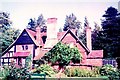
Elephant Cottage
This brick and timber house probably dates from the late 16th century; by the 19th century it was an inn, the Elephant & Castle, but later reverted to a private residence, being for many years the home of Len Merriman, organist at St Laurence's church http://ic.pics.livejournal.com/jy100/8671696/156850/156850_original.jpg
This rear view gives a charming glimpse of a traditional English country garden.
The frontage to the Old Warwick Road as shown in an old photograph http://ic.pics.livejournal.com/jy100/8671696/156636/156636_1000.jpg
Image: © Tiger
Taken: Unknown
0.07 miles
3
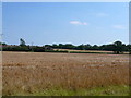
Wheat Field at Turners Green
This field of nearly ripe wheat is just off the minor road between Rowington and Turners Green. In the background can be seen the houses in Rowington.
Image: © Nigel Mykura
Taken: 22 Jul 2012
0.11 miles
5
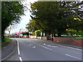
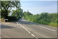
Old Warwick Road Rowington
The main gates to the village church are on the right along with the compulsory yew tree. In the distance the shell of a cottage is being renovated. The signs on the road indicate a 40 m.p.h. speed limit in the village.
Image: © Nigel Mykura
Taken: 14 Apr 2012
0.14 miles
6
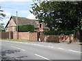
Converted barn at the Old Vicarage
The former vicarage itself is a big brick Georgian box of a house. Postbox number CV35 120 is seen in detail in James Yardley's Image
Image: © Robin Stott
Taken: 20 Jun 2011
0.14 miles

8
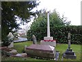
Old Warwick Road glimpsed from Rowington Churchyard
Image: © Basher Eyre
Taken: 8 Feb 2019
0.14 miles
9
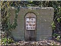
Mile Post, Rowington
Opposite St. Laurence's Church, just off the B4439.
"To Warwick 6:Mile Birm:14"
Image: © David P Howard
Taken: 3 Apr 2013
0.15 miles
10
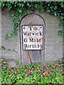
Old Milepost by the B4439, Rowington
Metal plate attached to wooden post by the B4439, in parish of ROWINGTON (WARWICK District), opposite Church gate near entrance to Rowington Hall, on the verge at base of hedge, on West side of road. Erected by the Hatton to Bromsgrove turnpike trust in the 19th century.
Inscription reads:-
To
Warwick
6: Mile
Birm:14
Milestone Society National ID: WA_WABM06.
Image: © J & KS
Taken: 14 Apr 2002
0.15 miles