IMAGES TAKEN NEAR TO
Middleton Close, WARWICK, CV35 0SQ
Introduction
This page details the photographs taken nearby to Middleton Close, CV35 0SQ by members of the Geograph project.
The Geograph project started in 2005 with the aim of publishing, organising and preserving representative images for every square kilometre of Great Britain, Ireland and the Isle of Man.

There are currently over 7.5m images from over14,400 individuals and you can help contribute to the project by visiting https://www.geograph.org.uk
Image Map
Images are licensed for reuse under creativecommons.org/licenses/by-sa/2.0
Notes
- Clicking on the map will re-center to the selected point.
- The higher the marker number, the further away the image location is from the centre of the postcode.
Image Listing (36 Images Found)
Images are licensed for reuse under creativecommons.org/licenses/by-sa/2.0
Image
Details
Distance
2
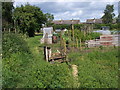
Seven Shires Way
Seven Shires Way by the allotments off Tysoe Hill road in Upper Tysoe
Image: © Shaun Ferguson
Taken: 22 May 2011
0.07 miles
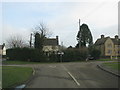
3
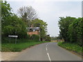
Junction, Upper Tysoe
Looking right from Image The Centenary Way follows this road across the junction towards Middle Tysoe. The right turn is for Banbury; the left turn, Old Tree Lane, makes a loop to rejoin this road just left of the camera, renamed as Baldwins Lane.
Image: © Derek Harper
Taken: 4 Nov 2022
0.08 miles
4
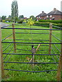
Commemorative tree
On the village green is this commemorative tree. The plate reads "A Black Mulberry given to the village in 2006 commemorating 400 years of The Fruiterers Company whose charter was granted in 1606"
Image: © Michael Dibb
Taken: 2 Jun 2012
0.09 miles
7
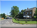
Upper Tysoe
Looking towards the Shenington Road and Tysoe Hill from the junction with Epwell Road.
Image: © David Stowell
Taken: 10 Jun 2006
0.10 miles
8
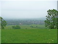
Murky view
On a murky day, a view of Upper Tysoe from alongside the windmill on Windmill Hill.
Image: © Michael Dibb
Taken: 2 Jun 2012
0.10 miles
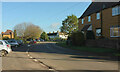
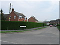
9
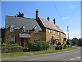
Houses in Upper Tysoe
A row of modern house built in the local stile and faced with ironstone to match the rest of the village.
Image: © David Stowell
Taken: 10 Jun 2006
0.10 miles
10
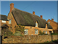
Listed cottage, Upper Tysoe
The Thatched House https://historicengland.org.uk/listing/the-list/list-entry/1186194?section=official-list-entry is also shown at Image
Image: © Derek Harper
Taken: 4 Nov 2022
0.10 miles