
IMAGES TAKEN NEAR TO
Park Piece, WARWICK, CV35 0NT
Introduction
This page details the photographs taken nearby to Park Piece, CV35 0NT by members of the Geograph project.
The Geograph project started in 2005 with the aim of publishing, organising and preserving representative images for every square kilometre of Great Britain, Ireland and the Isle of Man.

There are currently over 7.5m images from over14,400 individuals and you can help contribute to the project by visiting https://www.geograph.org.uk
Image Map
Images are licensed for reuse under creativecommons.org/licenses/by-sa/2.0
Notes
- Clicking on the map will re-center to the selected point.
- The higher the marker number, the further away the image location is from the centre of the postcode.
Image Listing (83 Images Found)
Images are licensed for reuse under creativecommons.org/licenses/by-sa/2.0
Image
Details
Distance
1
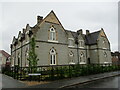
Roxburgh House, Kineton
A former school designed by William Lait 1863.
Image: © Jonathan Thacker
Taken: 25 Aug 2022
0.04 miles
2
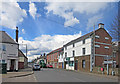
Warwick Road, Kineton
The road heading west out of Kineton.
Image: © Des Blenkinsopp
Taken: 26 Apr 2016
0.09 miles
3
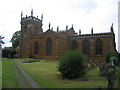
Kineton Church
St Peter's Church, located in the middle of the village.
Image: © David Stowell
Taken: 14 Aug 2005
0.12 miles
4
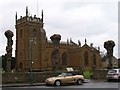
St Peter's Church, Kineton
South side of the church on a grey February day. The line of pollarded trees that runs the length of the churchyard were heavily pruned the previous day, and allow a view of the church from this position. http://www.edgehillbenefice.co.uk/
Image: © David P Howard
Taken: 2 Feb 2011
0.12 miles
6
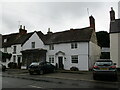
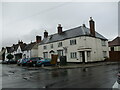
House and shop, Bridge Street, Kineton
Dates from the seventeenth century https://historicengland.org.uk/listing/the-list/list-entry/1381888?section=official-list-entry
Image: © Jonathan Thacker
Taken: 25 Aug 2022
0.13 miles
7
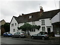
3-6 Bridge Street, Kineton
Originally of the seventeenth century https://historicengland.org.uk/listing/the-list/list-entry/1381885?section=official-list-entry
Image: © Jonathan Thacker
Taken: 25 Aug 2022
0.13 miles
8
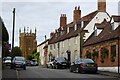
Houses on Bridge Street
Houses on Bridge Street in Kineton, with the tower of St Peter's church in the distance.
Image: © Philip Halling
Taken: 28 Sep 2024
0.13 miles
9
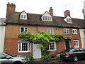
Langdale, Kineton
Listed as part of Dene House https://historicengland.org.uk/listing/the-list/list-entry/1381887?section=official-list-entry
Image: © Jonathan Thacker
Taken: 25 Aug 2022
0.13 miles
10
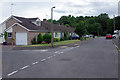
Castle Road, Kineton
Castle Road is a cul-de-sac at the western end of Kineton village that includes a number of semi-detached bungalows; Castle Crescent leads off to the left in this view. The name comes from its proximity to the remains of King John's motte and bailey castle which is located in the woodland at the end of the road.
Image: © Stephen McKay
Taken: 5 Aug 2020
0.13 miles