
IMAGES TAKEN NEAR TO
Glosters Green, WARWICK, CV35 0LT
Introduction
This page details the photographs taken nearby to Glosters Green, CV35 0LT by members of the Geograph project.
The Geograph project started in 2005 with the aim of publishing, organising and preserving representative images for every square kilometre of Great Britain, Ireland and the Isle of Man.

There are currently over 7.5m images from over14,400 individuals and you can help contribute to the project by visiting https://www.geograph.org.uk
Image Map
Images are licensed for reuse under creativecommons.org/licenses/by-sa/2.0
Notes
- Clicking on the map will re-center to the selected point.
- The higher the marker number, the further away the image location is from the centre of the postcode.
Image Listing (51 Images Found)
Images are licensed for reuse under creativecommons.org/licenses/by-sa/2.0
Image
Details
Distance
1
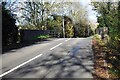
Old railway bridge
This old bridge is on Southam Road, Kineton. It was built for the Stratford & Midland Junction Railway, which was closed in 1965.
Image: © Bob Walters
Taken: 19 Nov 2022
0.06 miles
2
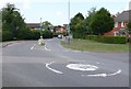
St Peters Rd
View south down St Peters Rd . The roundabout in the foreground is on the Southam road out of Kineton.
Image: © Nigel Mykura
Taken: 2 Jul 2011
0.06 miles
3
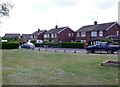
St Peters Rd
This small patch of green grass is at the junction of this circular road where it meets the Southam Rd out of Kineton. The road is mostly mdern semi-detached houses.
Image: © Nigel Mykura
Taken: 2 Jul 2011
0.07 miles
4
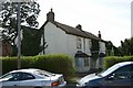
Last chance to see
By the time you view this picture the house it shows will probably be gone. This nice old farmhouse in Kineton has been surrounded by new housing and despite being converted to flats, was finally abandoned some years ago. According to local people at the time the pic was taken, the site is due for redevelopment by a housing association.
Image: © Colin Craig
Taken: 10 Apr 2011
0.12 miles
5
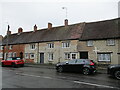
Cottages, Southam Street, Kineton
Eighteenth and nineteenth century cottages. No.4, in the centre of the picture was once three cottages and may date back to the late sevebteenth century but has been extensively altered https://historicengland.org.uk/listing/the-list/list-entry/1381913?section=official-list-entry
Image: © Jonathan Thacker
Taken: 25 Aug 2022
0.13 miles
6
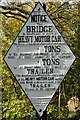
Railway bridge sign
This restored sign is adjacent to the old railway bridge in Lighthorne Road, Kineton. It was originally erected sometime after 1909 when the railway line became the Stratford & Midland Junction Railway.
Image: © Bob Walters
Taken: 19 Nov 2022
0.13 miles
7
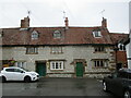
Cottages, Market Place, Kineton
Dated 1671 https://historicengland.org.uk/listing/the-list/list-entry/1381903?section=official-list-entry
Image: © Jonathan Thacker
Taken: 25 Aug 2022
0.14 miles
8
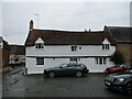
Coffee House Cottage, Kineton
Dates from about 1600 https://historicengland.org.uk/listing/the-list/list-entry/1381907?section=official-list-entry
Image: © Jonathan Thacker
Taken: 25 Aug 2022
0.15 miles
9
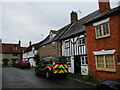
Cottages, Market Place, Kineton
Tudor Cottage (with half timbering) dates to about 1600 https://historicengland.org.uk/listing/the-list/list-entry/1381911?section=official-list-entry Next to it is Box Tree Cottage which is of similar date but with a nineteenth century refronting https://historicengland.org.uk/listing/the-list/list-entry/1381906?section=official-list-entry Beyond that is Coffee House Cottage, again of about 1600 https://historicengland.org.uk/listing/the-list/list-entry/1381907?section=official-list-entry
Image: © Jonathan Thacker
Taken: 25 Aug 2022
0.15 miles
10
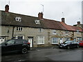
Cottages, Southam Street, Kineton
Date from about 1800.
Image: © Jonathan Thacker
Taken: 25 Aug 2022
0.15 miles