
IMAGES TAKEN NEAR TO
Plantagenet Trading Estate, Warwick Road, WARWICK, CV35 0HU
Introduction
This page details the photographs taken nearby to Plantagenet Trading Estate, Warwick Road, CV35 0HU by members of the Geograph project.
The Geograph project started in 2005 with the aim of publishing, organising and preserving representative images for every square kilometre of Great Britain, Ireland and the Isle of Man.

There are currently over 7.5m images from over14,400 individuals and you can help contribute to the project by visiting https://www.geograph.org.uk
Image Map
Images are licensed for reuse under creativecommons.org/licenses/by-sa/2.0
Notes
- Clicking on the map will re-center to the selected point.
- The higher the marker number, the further away the image location is from the centre of the postcode.
Image Listing (13 Images Found)
Images are licensed for reuse under creativecommons.org/licenses/by-sa/2.0
Image
Details
Distance
1
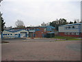
Industrial estate, Kineton
This industrial estate on the west of the town is on the site of the former railway station and goods yard. The line ran roughly where the blue ended building and the building on the right of the picture are situated.
Image: © David Stowell
Taken: 2 Jan 2006
0.05 miles
2
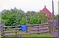
Site of former Kineton station
View SW, from the B4086 road, towards Stratford-on-Avon and Broom Junction: ex-Stratford-on-Avon & Midland Junction line, Broom - Stratford - Blisworth/Olney (Ravenstone Wood Jct.). The station had been closed to passengers since 7/4/52, when services Stratford - Blisworth ceased (Broom - Stratford ceased earlier, 23/5/49). Goods continued until 11/11/63 (through to Broom, 13/6/60), with Military traffic from Burton Dassett Depot; this still uses the line eastward to Fenny Compton.
Image: © Ben Brooksbank
Taken: 13 Jul 2007
0.06 miles
3

King John's Castle, Kineton
This shallow mound is all that remains of the former motte and bailey castle thought to date from the time of King John. It is much reduced in size from its heyday, when a timber-built castle and defensive ramparts allowed the king's men to control this route between London and the midlands. The area is now a nature reserve.
Image: © Colin Craig
Taken: 16 Sep 2009
0.07 miles
4
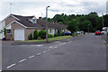
Castle Road, Kineton
Castle Road is a cul-de-sac at the western end of Kineton village that includes a number of semi-detached bungalows; Castle Crescent leads off to the left in this view. The name comes from its proximity to the remains of King John's motte and bailey castle which is located in the woodland at the end of the road.
Image: © Stephen McKay
Taken: 5 Aug 2020
0.09 miles
5

King John's Castle
The mound here, tucked away in woodland close to Kineton village, was a motte and bailey castle built in the 12th or 13th century. It has eroded away since then and its height is significantly less than it would have been originally. It is possible that it was constructed by King John during the Baron's Revolt of 1215-17 as a way of guarding the crossing of the River Dene on what was then a major route between London and Warwick. This theory is supported by the fact that the king owned land here (the name Kineton is derived from King's Town). The bench in the foreground is dedicated to Brigadier Peter Holdsworth, a former vice chairman of Kineton Parish Council.
Image: © Stephen McKay
Taken: 5 Aug 2020
0.10 miles
6

King John's Castle
This is the top of a motte and bailey castle built in the 12th or 13th century. The mound has eroded away since then and its height is significantly less than it would have been originally. It is possible that it was constructed by King John during the Baron's Revolt of 1215-17 as a way of guarding the crossing of the River Dene on what was then a major route between London and Warwick. This theory is supported by the fact that the king owned land here (the name Kineton is derived from King's Town). The castle is now a scheduled ancient monument.
Image: © Stephen McKay
Taken: 5 Aug 2020
0.10 miles
7
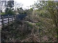
Bridge on S&MJR, Kineton
This bridge is on the B4086 as it enters Kineton. It is one of many in the area left over when the Stratford and Midland Junction Railway ceased to exist. This one is unusual in that it has been completely filled in on both sides, leaving these steep ramps of earth.
Image: © David P Howard
Taken: 22 Apr 2010
0.10 miles
8
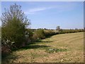
Field alongside B4086, Kineton
Field by the roadside just as it enters the village.
Image: © David P Howard
Taken: 22 Apr 2010
0.14 miles
9
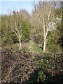
Old cutting on S&MJR, Kineton
View from the bridge on the B4086 just as it enters Kineton, along the route of the long ago dismantled and now completely overgrown Stratford and Midland Junction Railway.
Image: © David P Howard
Taken: 22 Apr 2010
0.14 miles
10
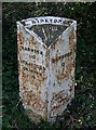
Milepost at Kineton
This post is on the side of the B4086 just before it enters Kineton. It reads London 86, Warwick 10, Stratford On Avon 9, Banbury 13. http://www.britishlistedbuildings.co.uk/en-482307-milepost-at-ngr-sp-328-513-kineton
Image: © David P Howard
Taken: 22 Apr 2010
0.18 miles