
IMAGES TAKEN NEAR TO
Chesterton Road, WARWICK, CV35 0AB
Introduction
This page details the photographs taken nearby to Chesterton Road, CV35 0AB by members of the Geograph project.
The Geograph project started in 2005 with the aim of publishing, organising and preserving representative images for every square kilometre of Great Britain, Ireland and the Isle of Man.

There are currently over 7.5m images from over14,400 individuals and you can help contribute to the project by visiting https://www.geograph.org.uk
Image Map
Images are licensed for reuse under creativecommons.org/licenses/by-sa/2.0
Notes
- Clicking on the map will re-center to the selected point.
- The higher the marker number, the further away the image location is from the centre of the postcode.
Image Listing (11 Images Found)
Images are licensed for reuse under creativecommons.org/licenses/by-sa/2.0
Image
Details
Distance
3
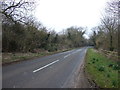
Chesterton Road
Heading north towards Chesterton Green.
Image: © JThomas
Taken: 4 Apr 2013
0.04 miles
4
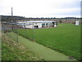
Cricket Club, Lighthorne
The village of Lighthorne is in a small valley and in order to get sufficient space the cricket pitch is located slightly outside the village beside the road to Chesterton Hill.
Image: © David Stowell
Taken: 18 Dec 2005
0.08 miles
5
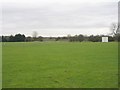
Lighthorne cricket pitch
Looking south across the cricket pitch - not in the best of condition in the winter months!
Image: © David Stowell
Taken: 18 Dec 2005
0.08 miles
9
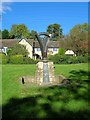
Millennium Sign, Lighthorne
This sign is on a grass bank to the south of The Bank near the centre of the village. It is to commemorate the millennium.
The small plaque just above the stone says, "This Village sign was officially unveiled and handed into the ownership of the Lighthorne Parish Council by the Chairman of the Warwickshire County Council, Councillor Mota Singh, on behalf of the Lighthorne Millennium Committee on the 20th May 2001"
The large plaque on the front of the stone says, "2000 Celebrating a village and its people. This sign was designed by Tony Hunter, a resident of the village from an original idea for a Millennium memorial by Peter Arnis, another Lighthorne resident. Incorporating local materials, it is intended to stand as a symbol of the village community. The sign is mounted on a Lighthorne stone base reclaimed from an old building once standing on The Bank. It comprises two curved pieces of English Oak symbolising the hills on either side of the village. The valley formed between the two pieces of wood contains a stainless steel symbolic silhouette of the village with the word Lighthorne joining the two wooden hills. Mounted on the stone base are two stainless steel plates. This one contains a short description of the Millennium project together with an engraved line drawing map of the village as it was at the turn of the century. On the other side is a reproduction of the electoral register for the village for the year 2000."
Below the line map is a list of acknowledgements for various sponsors, and the name of the constructor A.G. Knapton. Right at the bottom is a web http://www.lighthorneonline.com/
Image: © David P Howard
Taken: 17 Oct 2010
0.23 miles
10
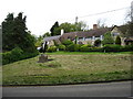
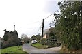
Cottages in Lighthorne
The Millennium Sign is seen on the left: see Image
Image: © David Purchase
Taken: 11 May 2014
0.23 miles