
IMAGES TAKEN NEAR TO
Banbury Road, WARWICK, CV34 6YE
Introduction
This page details the photographs taken nearby to Banbury Road, CV34 6YE by members of the Geograph project.
The Geograph project started in 2005 with the aim of publishing, organising and preserving representative images for every square kilometre of Great Britain, Ireland and the Isle of Man.

There are currently over 7.5m images from over14,400 individuals and you can help contribute to the project by visiting https://www.geograph.org.uk
Image Map
Images are licensed for reuse under creativecommons.org/licenses/by-sa/2.0
Notes
- Clicking on the map will re-center to the selected point.
- The higher the marker number, the further away the image location is from the centre of the postcode.
Image Listing (92 Images Found)
Images are licensed for reuse under creativecommons.org/licenses/by-sa/2.0
Image
Details
Distance
1
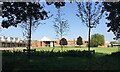
The new home, King's High School for Girls, Warwick School site, Banbury Road
Last photographed in February 2018 Image Parts of the former town centre site are now flattened and presumed to be awaiting development.
Image: © Robin Stott
Taken: 20 Sep 2020
0.00 miles
2
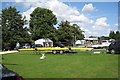
Myton Fields, Warwick
Part of the greenspace has been given over to a weekend rowing event on the River Avon.
Image: © Robin Stott
Taken: 22 Aug 2009
0.04 miles
3

The end of an evening, Warwick Folk Festival 2016
The Warwick Folk Festival takes place in the grounds of Warwick School over a weekend in summer. Some events take place in the town. https://www.efestivals.co.uk/festivals/warwick/2017/ http://www.warwickschool.org
Image: © Robin Stott
Taken: 22 Jul 2016
0.04 miles
4
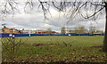
Building the new King's High at Warwick School, Myton, Warwick
The independent Warwick High School for Girls will be leaving its town centre site for a new home at Warwick School for Boys, another independent. The Warwick School site never stops growing.
Image: © Robin Stott
Taken: 20 Feb 2018
0.04 miles
5
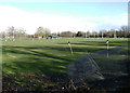
Warwick School playing fields
Viewed from the Banbury Road. Must be a good 12 hectares of well-kept sports turf.
"Independent school for boys, 7 to 18, day and boarding.
School dates back to 914, oldest boys' school in the country."
http://www.warwickschool.org/
Image: © Robin Stott
Taken: 9 Mar 2009
0.07 miles
6
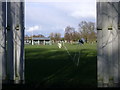
Warwick School playing fields
Overwintering cricket pavilion and screens. Wintry shower over Leamington Spa.
Image: © Robin Stott
Taken: 9 Mar 2009
0.08 miles
7
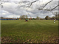
Warwick School rugby pitches
The view is from Banbury Road https://www.warwickschool.org On the left is the new site for King's High School for Girls Image
Image: © Robin Stott
Taken: 20 Feb 2018
0.09 miles
8
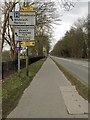
All the signs, Banbury Road, Warwick, 2018
The road sign is supplemented by directions to some of the many new estates going up in south Warwick.
Image: © Robin Stott
Taken: 1 Apr 2018
0.09 miles
9
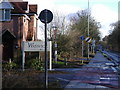
Banbury Road A425, looking SE
All the signs…
Image: © Robin Stott
Taken: 9 Mar 2009
0.10 miles
10
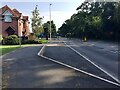
Changes on Banbury Road, Warwick
The recent relocation of King's High School for Girls to the Warwick School site has required light signals at the entrance and a layby. There are now light signals at the Gallows Hill turn down the road. In 2009 it was a clear run, as seen in this similar view Image
Image: © Robin Stott
Taken: 20 Sep 2020
0.10 miles